
MyTopo
Cayuse Oregon US Topo Map
Couldn't load pickup availability
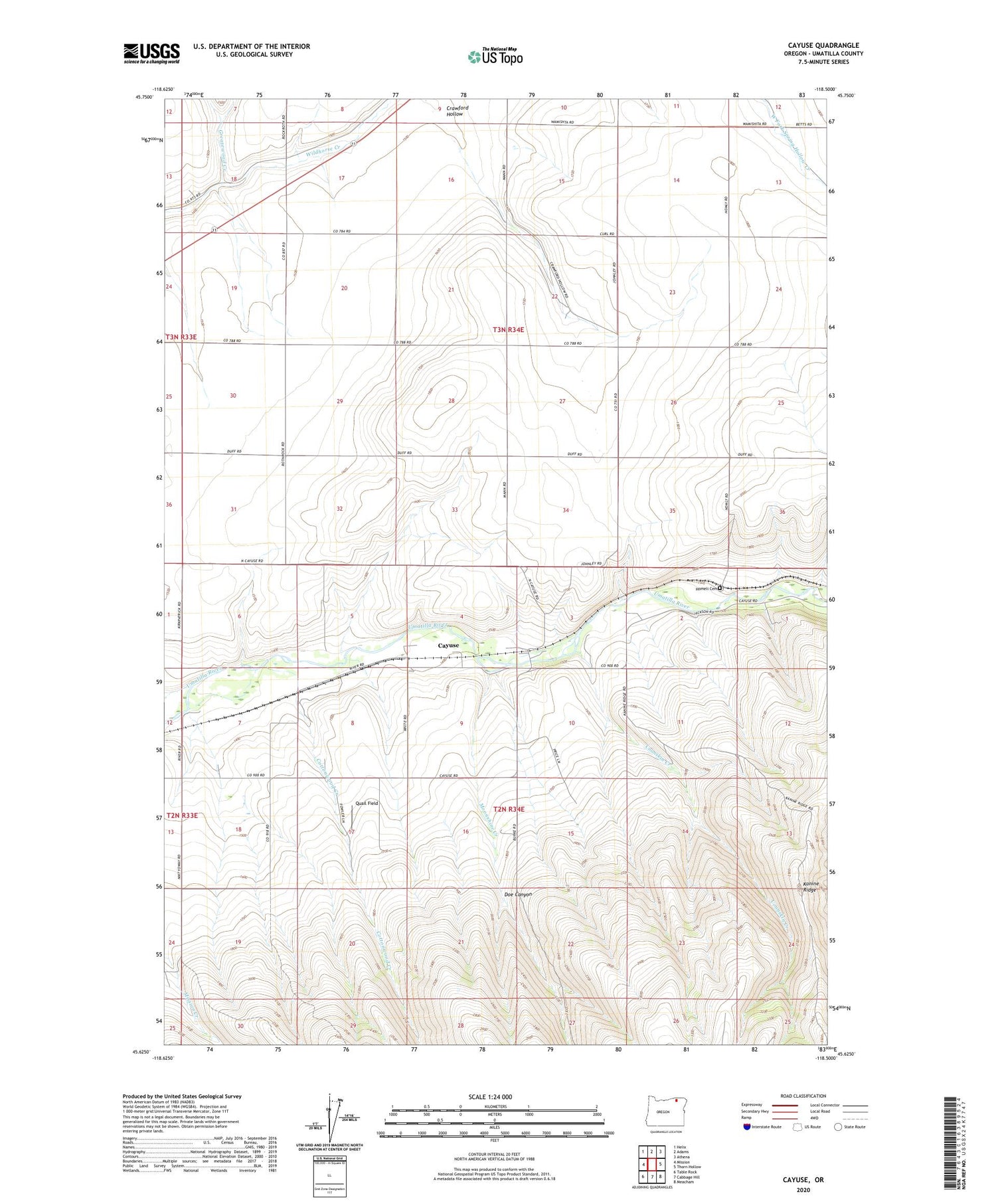
2020 topographic map quadrangle Cayuse in the state of Oregon. Scale: 1:24000. Based on the newly updated USGS 7.5' US Topo map series, this map is in the following counties: Umatilla. The map contains contour data, water features, and other items you are used to seeing on USGS maps, but also has updated roads and other features. This is the next generation of topographic maps. Printed on high-quality waterproof paper with UV fade-resistant inks.
Quads adjacent to this one:
West: Mission
Northwest: Helix
North: Adams
Northeast: Athena
East: Thorn Hollow
Southeast: Meacham
South: Cabbage Hill
Southwest: Table Rock
Contains the following named places: Blakeley, Cayuse, Cayuse Census Designated Place, Cayuse Post Office, Coonskin Creek, Cottonwood Creek, Crawford Hollow, Doe Canyon, Eastland, Greasewood Creek, Homeli Cemetery, Homly, Kanine Ridge, Minthorn, Moonshine Creek, Quail Field, Saint Andrews School, Sumpkin, Umatilla Reservation, Umatilla Reservation Division, West Fork Greasewood Creek


