MyTopo
Burnt Flat Oregon US Topo Map
Couldn't load pickup availability
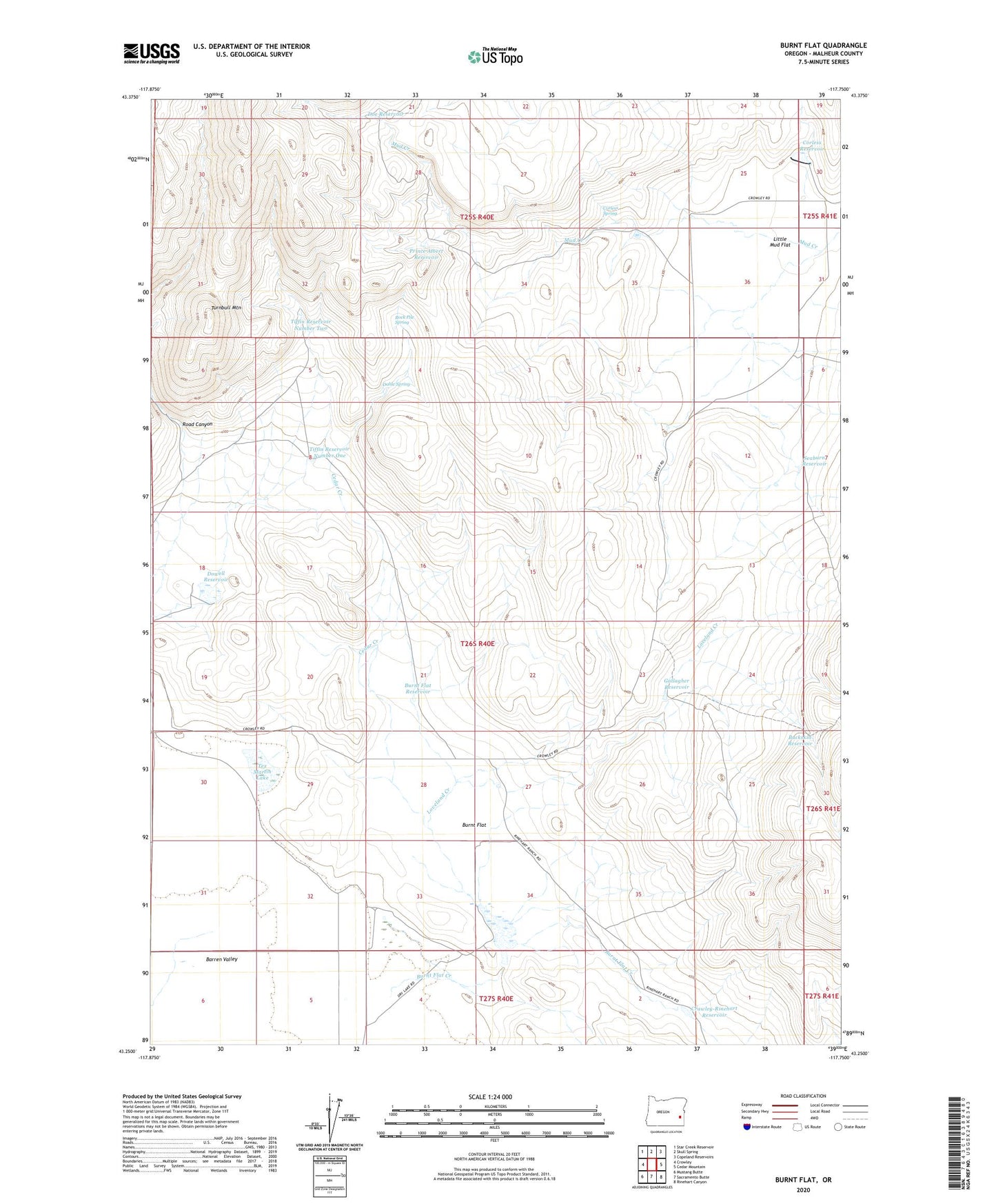
2023 topographic map quadrangle Burnt Flat in the state of Oregon. Scale: 1:24000. Based on the newly updated USGS 7.5' US Topo map series, this map is in the following counties: Malheur. The map contains contour data, water features, and other items you are used to seeing on USGS maps, but also has updated roads and other features. This is the next generation of topographic maps. Printed on high-quality waterproof paper with UV fade-resistant inks.
Quads adjacent to this one:
West: Crowley
Northwest: Star Creek Reservoir
North: Skull Spring
Northeast: Copeland Reservoirs
East: Cedar Mountain
Southeast: Rinehart Canyon
South: Sacramento Butte
Southwest: Mustang Butte
This map covers the same area as the classic USGS quad with code o43117c7.
Contains the following named places: Buckskin Reservoir, Burnt Flat, Burnt Flat Creek, Burnt Flat Reservoir, Cedar Creek, Corless Dam, Corless Reservoir, Corless Spring, Crawley-Rinehart Reservoir, Dahle Spring, Doe Reservoir, Dowell Reservoir, Fangollano Post Office, Frying Pan Ranch, Gallagher Reservoir, Jack Well, Loveland Creek, Mud Creek, Prince Albert Reservoir, Road Canyon, Rock Pile Spring, Seaburn Reservoir, Seaburn Well, Tex Martin Lake, Tiffin Reservoir Number One, Tiffin Reservoir Number Two, Turnbull Mountain