MyTopo
Skull Spring Oregon US Topo Map
Couldn't load pickup availability
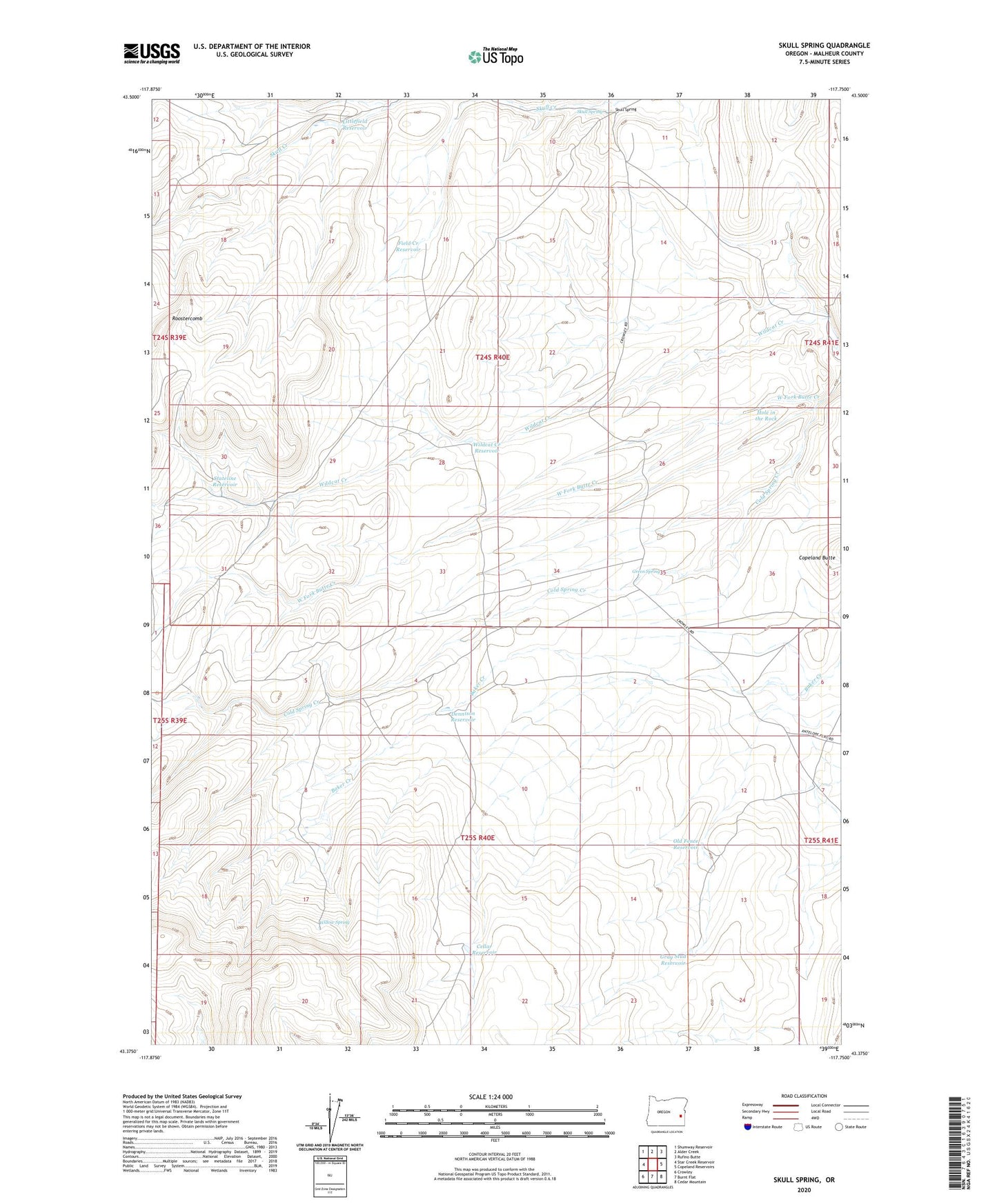
2023 topographic map quadrangle Skull Spring in the state of Oregon. Scale: 1:24000. Based on the newly updated USGS 7.5' US Topo map series, this map is in the following counties: Malheur. The map contains contour data, water features, and other items you are used to seeing on USGS maps, but also has updated roads and other features. This is the next generation of topographic maps. Printed on high-quality waterproof paper with UV fade-resistant inks.
Quads adjacent to this one:
West: Star Creek Reservoir
Northwest: Shumway Reservoir
North: Alder Creek
Northeast: Rufino Butte
East: Copeland Reservoirs
Southeast: Cedar Mountain
South: Burnt Flat
Southwest: Crowley
This map covers the same area as the classic USGS quad with code o43117d7.
Contains the following named places: Baker Creek, Big Field Pit, Cellar Reservoir, Dennison Reservoir, Field Creek Reservoir, Gray Stud Reservoir, Green Spring, Harry Littlefield Ranch, Hole in the Rock, Juntura Division, Littlefield Reservoir, Old Fence Reservoir, Skull Spring, Skullspring Post Office, Stateline Reservoir, West Fork Butte Creek, Wildcat Creek Reservoir, Willow Spring