MyTopo
Chimney Peak Oregon US Topo Map
Couldn't load pickup availability
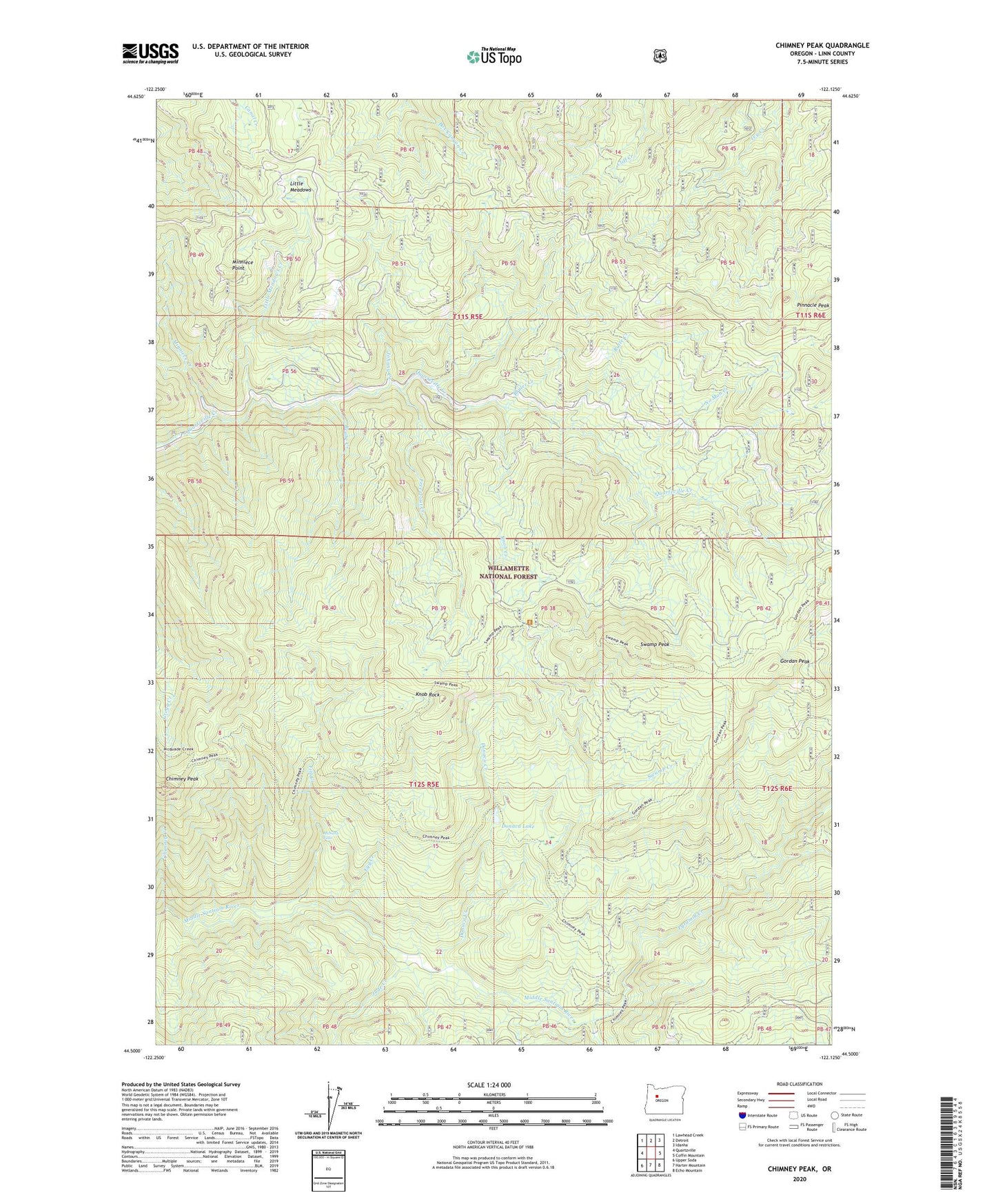
2020 topographic map quadrangle Chimney Peak in the state of Oregon. Scale: 1:24000. Based on the newly updated USGS 7.5' US Topo map series, this map is in the following counties: Linn. The map contains contour data, water features, and other items you are used to seeing on USGS maps, but also has updated roads and other features. This is the next generation of topographic maps. Printed on high-quality waterproof paper with UV fade-resistant inks.
Quads adjacent to this one:
West: Quartzville
Northwest: Lawhead Creek
North: Detroit
Northeast: Idanha
East: Coffin Mountain
Southeast: Echo Mountain
South: Harter Mountain
Southwest: Upper Soda
Contains the following named places: Beabe Creek, Bruler Creek, Butte Creek, Chimney Creek, Chimney Peak, Chimney Peak Trail, Detroit Ranger Station, Donaca Creek, Donaca Lake, Egg Creek, Fitt Creek, Freezeout Creek, Gordan Peak, Gordan Peak Trail, Hoover Recreation Site, Johnny Creek, Jude Creek, Knob Creek, Knob Rock, Little Meadows, Little Meadows Creek, McNabb Falls, McQuade Creek Shelter, Middle Santiam Wilderness, Minniece Creek, Minniece Point, No Man Creek, Pinnacle Peak, Pyramid Creek, Pyramid Trail, Scar Mountain Trail, Swamp Creek, Swamp Peak, Swamp Peak Trail