MyTopo
Collier Butte Oregon US Topo Map
Couldn't load pickup availability
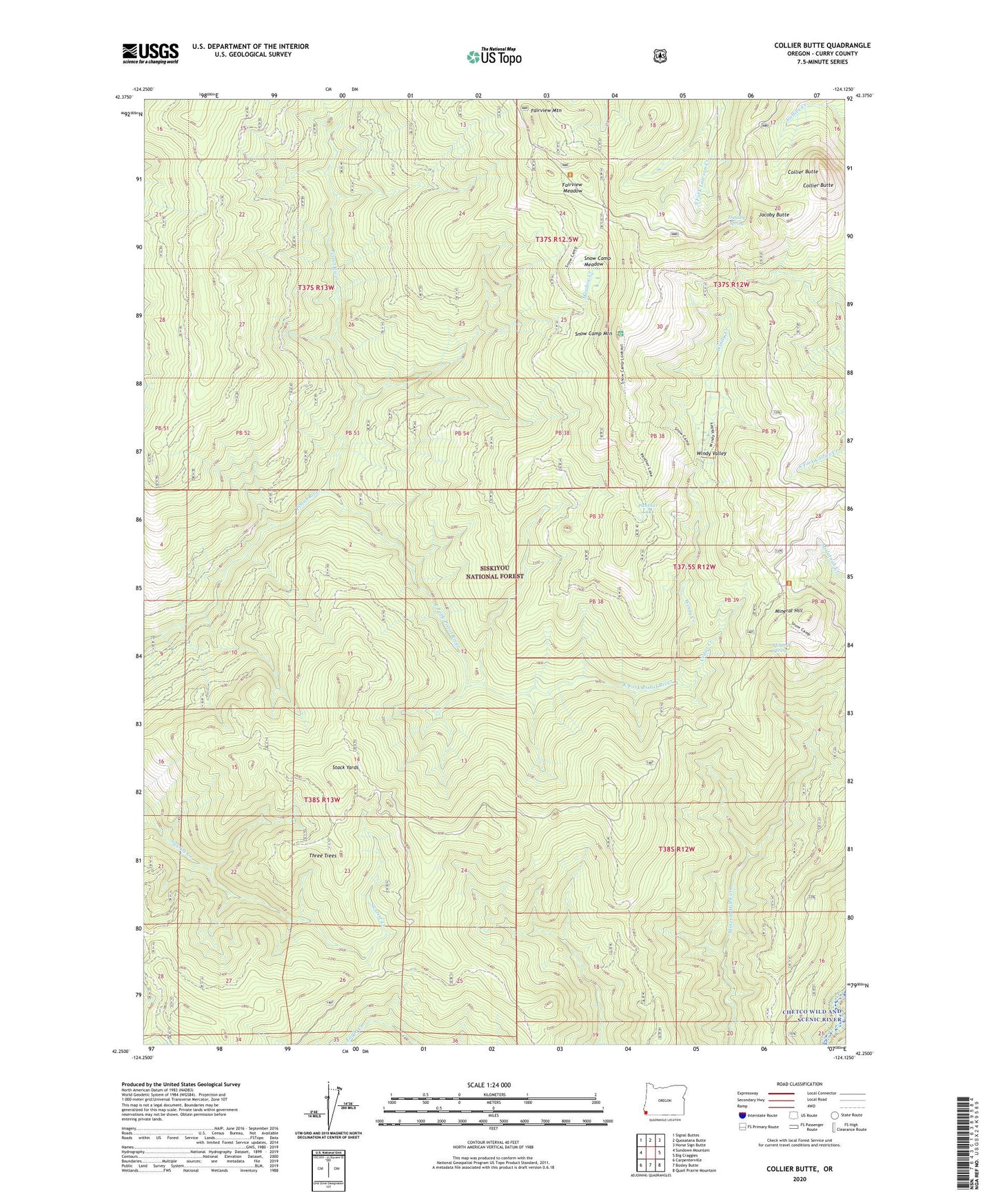
2020 topographic map quadrangle Collier Butte in the state of Oregon. Scale: 1:24000. Based on the newly updated USGS 7.5' US Topo map series, this map is in the following counties: Curry. The map contains contour data, water features, and other items you are used to seeing on USGS maps, but also has updated roads and other features. This is the next generation of topographic maps. Printed on high-quality waterproof paper with UV fade-resistant inks.
Quads adjacent to this one:
West: Sundown Mountain
Northwest: Signal Buttes
North: Quosatana Butte
Northeast: Horse Sign Butte
East: Big Craggies
Southeast: Quail Prairie Mountain
South: Bosley Butte
Southwest: Carpenterville
Contains the following named places: Brookings Division, Cedar Camp, Cedar Creek, Collier Butte, Eagle Creek Trail, East Fork Pistol River, Fairview Camp, Fairview Meadow, Fairview Mountain, Hazel Camp, Huntley Spring, Jacoby Butte, Meadow Creek, Mineral Hill, Mineral Spring, Panther Lake, Snow Camp Meadow, Snow Camp Mountain, Snow Camp Trail, Stack Yards, Three Tree Camp, Three Tree Lookout, Three Trees, Windy Creek, Windy Valley