MyTopo
Signal Buttes Oregon US Topo Map
Couldn't load pickup availability
Also explore the Signal Buttes Forest Service Topo of this same quad for updated USFS data
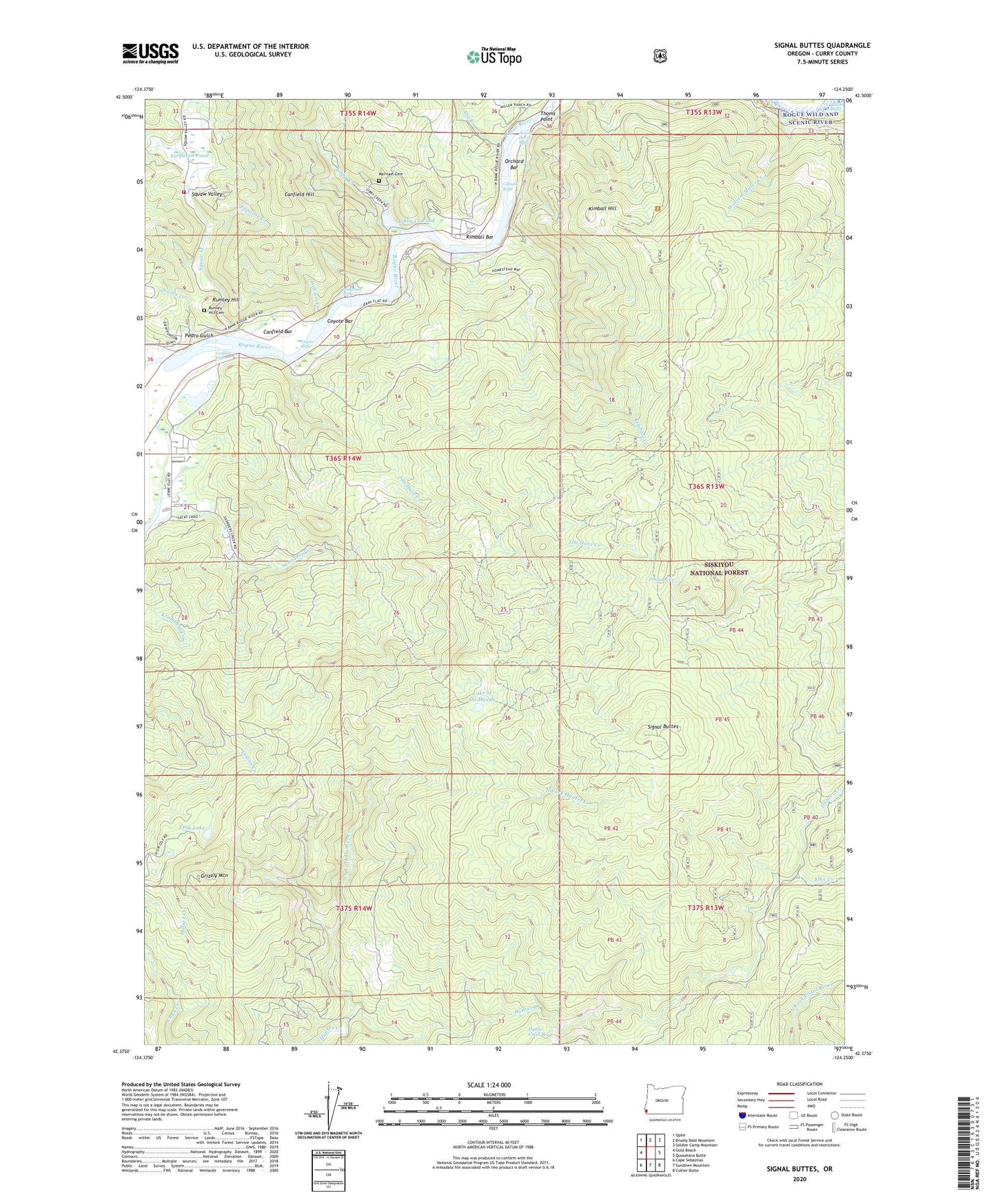
2023 topographic map quadrangle Signal Buttes in the state of Oregon. Scale: 1:24000. Based on the newly updated USGS 7.5' US Topo map series, this map is in the following counties: Curry. The map contains contour data, water features, and other items you are used to seeing on USGS maps, but also has updated roads and other features. This is the next generation of topographic maps. Printed on high-quality waterproof paper with UV fade-resistant inks.
Quads adjacent to this one:
West: Gold Beach
Northwest: Ophir
North: Brushy Bald Mountain
Northeast: Soldier Camp Mountain
East: Quosatana Butte
Southeast: Collier Butte
South: Sundown Mountain
Southwest: Cape Sebastian
This map covers the same area as the classic USGS quad with code o42124d3.
Contains the following named places: Abe Creek, Bagnell Ferry, Bagnell Post Office, Canfield Bar, Canfield Hill, Canfield Riffle, Cedar Valley Fire Department, Coldiron Camp, Coyote Bar, Coyote Riffle, Elko Creek, Ferguson Pond, Ferry Hole Boat Ramp, Frog Lake, Gillespie Riffle, Gold Beach Water Treatment Plant, Grizzly Mountain, Hafner Creek, Hawkins Riffle, Hooter Scooter Prairie, Huntley Park, Huntly Park Boat Launch, Jacks Prairie, Jackson Prairie, Jerrys Flat, Jim Hunt Creek, Jimmy Davis Riffle, Johnson Prairie, Kimball Bar, Kimball Creek, Kimball Hill, Lake of the Woods, Libby Creek, Libby Creek Pond, Long Prairie, McKinley Mine, Merriam Cemetery, North Fork Hunter Creek, Orchard Bar, Papoose Creek, Pedro Gulch, Pickle Ranch, Ragic Post Office, Rumley Hill, Rumley Hill Cemetery, Signal Buttes, Squaw Creek, Thoms Point, Wagontire Prairie, Wakeman Riffle, Walen Creek, William Creek, William Miller Creek