MyTopo
Danner Oregon US Topo Map
Couldn't load pickup availability
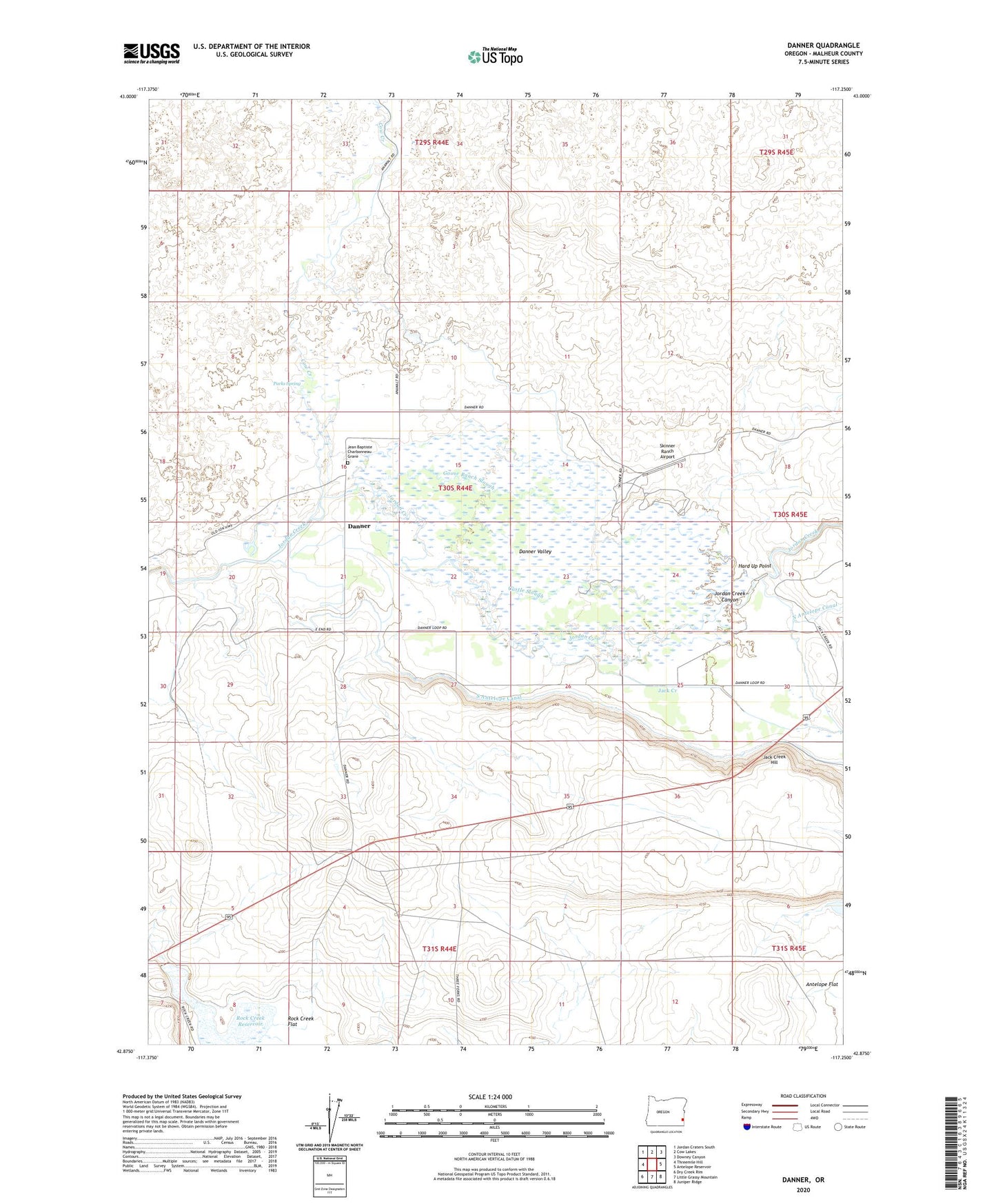
2024 topographic map quadrangle Danner in the state of Oregon. Scale: 1:24000. Based on the newly updated USGS 7.5' US Topo map series, this map is in the following counties: Malheur. The map contains contour data, water features, and other items you are used to seeing on USGS maps, but also has updated roads and other features. This is the next generation of topographic maps. Printed on high-quality waterproof paper with UV fade-resistant inks.
Quads adjacent to this one:
West: Threemile Hill
Northwest: Jordan Craters South
North: Cow Lakes
Northeast: Downey Canyon
East: Antelope Reservoir
Southeast: Juniper Ridge
South: Little Grassy Mountain
Southwest: Dry Creek Rim
This map covers the same area as the classic USGS quad with code o42117h3.
Contains the following named places: Barrick and Shannon Ranch, Castle Slough, Cow Creek, Danner, Danner Post Office, Danner Valley, Fort Dobie, Goose Ranch, Goose Ranch Slough, Hard Up Point, Jack Creek, Jack Creek Hill, Jean Baptiste Charbonneau Grave, Jordan Creek Canyon, North Antelope Canal, Palmer Dam, Parks Spring, Rock Creek Dam, Rock Creek Reservoir, Skinner, Skinner Dam, Skinner Ranch Airport, South Antelope Canal