
MyTopo
Deerhorn Creek Oregon US Topo Map
Couldn't load pickup availability
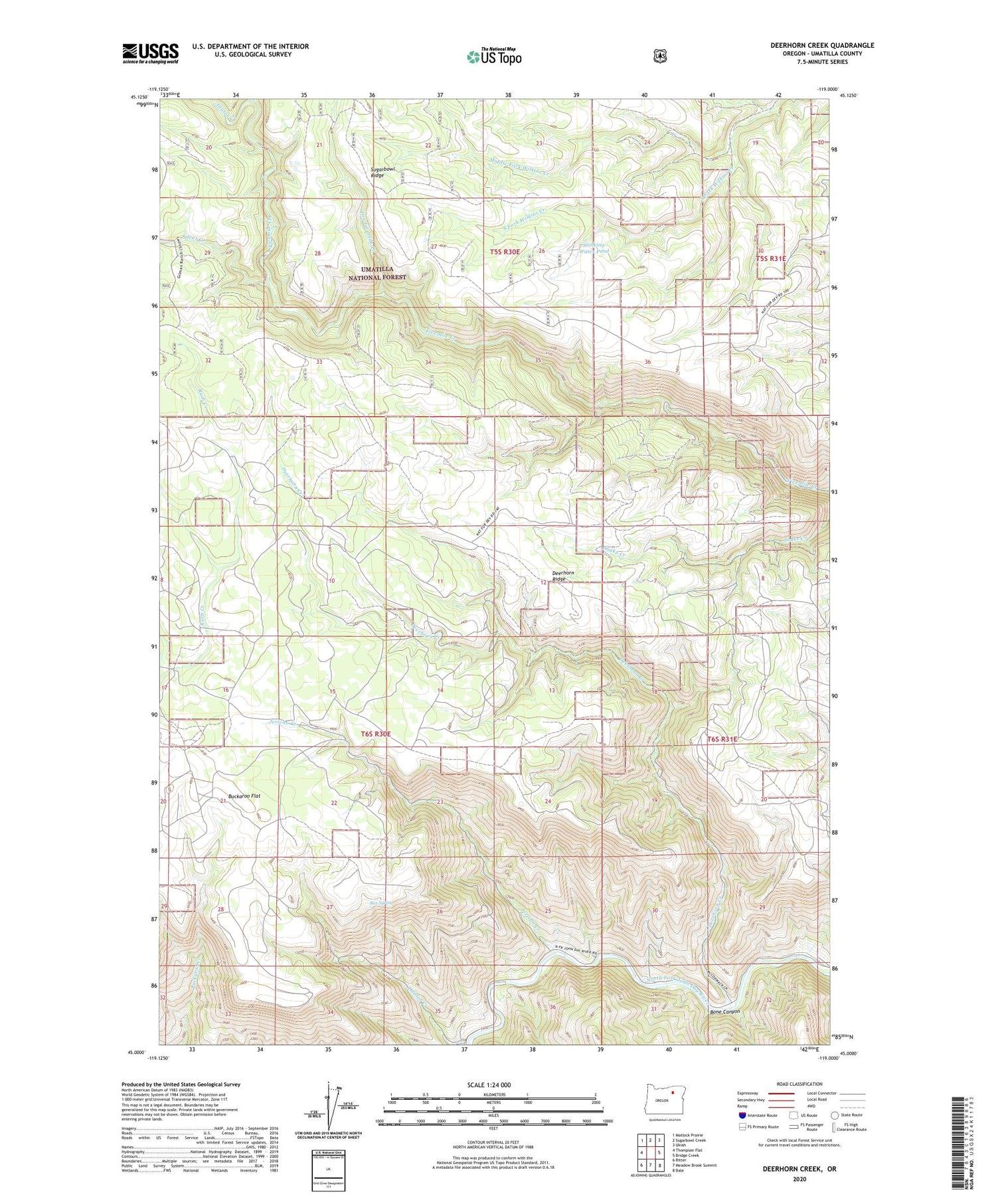
2020 topographic map quadrangle Deerhorn Creek in the state of Oregon. Scale: 1:24000. Based on the newly updated USGS 7.5' US Topo map series, this map is in the following counties: Umatilla. The map contains contour data, water features, and other items you are used to seeing on USGS maps, but also has updated roads and other features. This is the next generation of topographic maps. Printed on high-quality waterproof paper with UV fade-resistant inks.
Quads adjacent to this one:
West: Thompson Flat
Northwest: Matlock Prairie
North: Sugarbowl Creek
Northeast: Ukiah
East: Bridge Creek
Southeast: Dale
South: Meadow Brook Summit
Southwest: Ritter
Contains the following named places: Bone Canyon, Box Spring, Buckaroo Flat, Buckhorn Ranch, Deerhorn Creek, Deerhorn Ridge, Dry Fivemile Creek, Gulliford Crossing, Hunter Creek, Jericho Creek, Middle Fork Wilkins Creek, Silver Creek, South Fork Wilkins Creek, Stinking Water Pond, Taylor Creek


