MyTopo
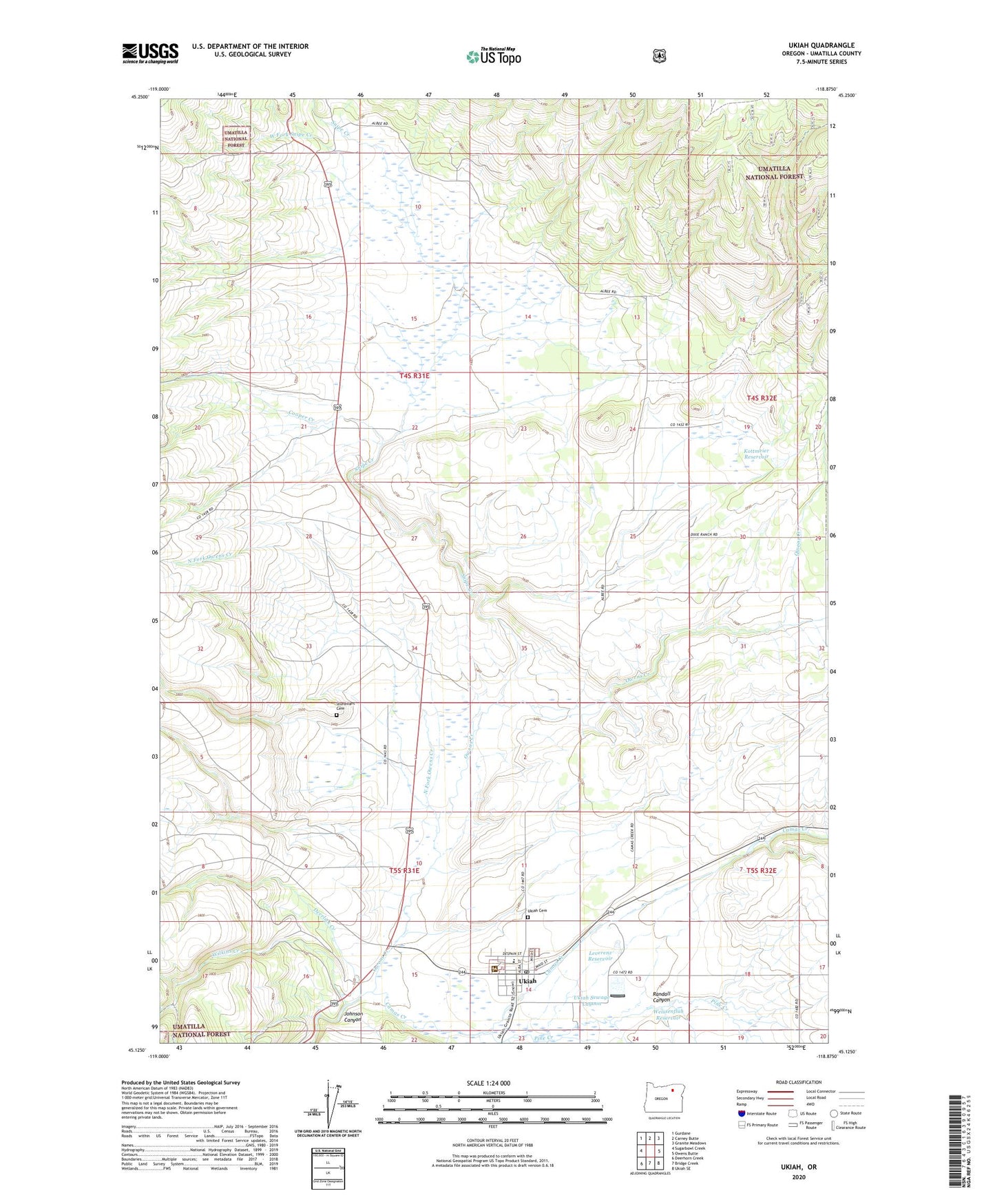
Ukiah Oregon US Topo Map
Couldn't load pickup availability
Also explore the Ukiah Forest Service Topo of this same quad for updated USFS data
2024 topographic map quadrangle Ukiah in the state of Oregon. Scale: 1:24000. Based on the newly updated USGS 7.5' US Topo map series, this map is in the following counties: Umatilla. The map contains contour data, water features, and other items you are used to seeing on USGS maps, but also has updated roads and other features. This is the next generation of topographic maps. Printed on high-quality waterproof paper with UV fade-resistant inks.
Quads adjacent to this one:
West: Sugarbowl Creek
Northwest: Gurdane
North: Carney Butte
Northeast: Granite Meadows
East: Owens Butte
Southeast: Ukiah SE
South: Bridge Creek
Southwest: Deerhorn Creek
This map covers the same area as the classic USGS quad with code o45118b8.
Contains the following named places: Albee, Albee Post Office, Camp McDowell, City of Ukiah, Cooper Creek, Deerlick Creek, Johnson Canyon, Kottmeier Reservoir, Leverenz Reservoir, North Fork John Day Ranger Station, North Fork Owens Creek, Owens Creek, Pine Creek, Randall Canyon, Snipe Creek, Sturdivant Cemetery, Ukiah, Ukiah Cemetery, Ukiah Post Office, Ukiah Public / School Library, Ukiah School, Ukiah Sewage Lagoon, Ukiah Sewage Lagoon Dam, Ukiah Wastewater Treatment Facility, Ukiah-Dale Forest State Park, Weissenfluh Reservoir, West Fork Snipe Creek, Wilkins Creek