MyTopo
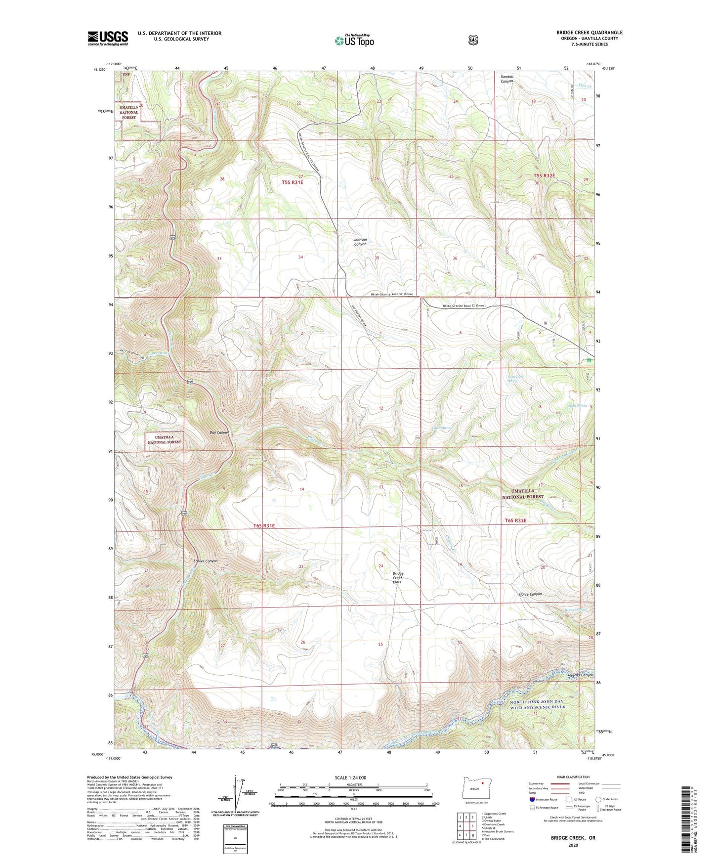
Bridge Creek Oregon US Topo Map
Couldn't load pickup availability
Also explore the Bridge Creek Forest Service Topo of this same quad for updated USFS data
2024 topographic map quadrangle Bridge Creek in the state of Oregon. Scale: 1:24000. Based on the newly updated USGS 7.5' US Topo map series, this map is in the following counties: Umatilla. The map contains contour data, water features, and other items you are used to seeing on USGS maps, but also has updated roads and other features. This is the next generation of topographic maps. Printed on high-quality waterproof paper with UV fade-resistant inks.
Quads adjacent to this one:
West: Deerhorn Creek
Northwest: Sugarbowl Creek
North: Ukiah
Northeast: Owens Butte
East: Ukiah SE
Southeast: The Cockscomb
South: Dale
Southwest: Meadow Brook Summit
This map covers the same area as the classic USGS quad with code o45118a8.
Contains the following named places: Bridge Creek, Bridge Creek Flats, Bridge Creek Wildlife Area, Camas Creek, Chilson Creek, Clark Spring, Day Canyon, Drift Fence Recreation Site, Fivemile Creek, Haden Creek, Lonoley, Meengs Spring, North Fork Bridge Creek, Skull Spring, Snake Creek, Stover Canyon, Twin Tank Spring, ZIP Code: 97880