MyTopo
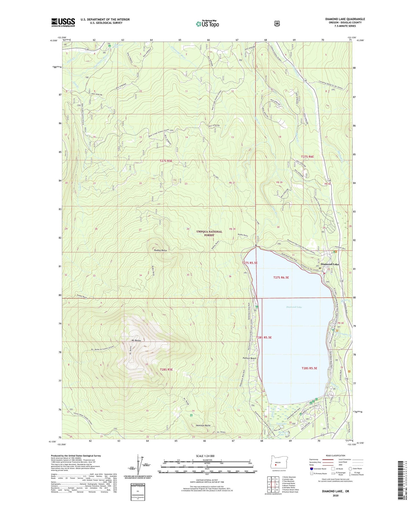
Diamond Lake Oregon US Topo Map
Couldn't load pickup availability
Also explore the Diamond Lake Forest Service Topo of this same quad for updated USFS data
2024 topographic map quadrangle Diamond Lake in the state of Oregon. Scale: 1:24000. Based on the newly updated USGS 7.5' US Topo map series, this map is in the following counties: Douglas. The map contains contour data, water features, and other items you are used to seeing on USGS maps, but also has updated roads and other features. This is the next generation of topographic maps. Printed on high-quality waterproof paper with UV fade-resistant inks.
Quads adjacent to this one:
West: Garwood Butte
Northwest: Potter Mountain
North: Lemolo Lake
Northeast: Tolo Mountain
East: Mount Thielsen
Southeast: Pumice Desert East
South: Pumice Desert West
Southwest: Hamaker Butte
This map covers the same area as the classic USGS quad with code o43122b2.
Contains the following named places: Beartrap Trail, Broken Arrow Recreation Site, Camp Creek, Camp Creek Forest Camp, Clearwater Falls, Clearwater Falls Recreation Site, Diamond Lake, Diamond Lake Campground Boat Ramp, Diamond Lake Guard Station, Diamond Lake Information Center, Diamond Lake Post Office, Diamond Lake Recreation Site, Diamond Lake South Shore Boat Ramp, Diamond Lake Trailer Camp Area, Diamond Lake Volunteer Fire Department, Dry Creek, Hemlock Butte, Horse Lake, Howlock Mountain Horse Camp, Lost Creek, Mount Bailey, Mount Bailey Trail, North End Boat Ramp, Oregon Cascades Recreation Area, Porcupine Creek, Pumice Beach, Rabbit and Porcupine Creek Forest Camp, Rabbit Creek, Rodley Butte, Rodley Butte Trail, Sheep Creek, Short Creek, Silent Creek, South Shore Recreation Site, Spruce Creek, Teal Lake, Thielsen View Recreation Site, Two Bear Creek, White Fir Forest Camp, ZIP Code: 97447