MyTopo
Dorena Lake Oregon US Topo Map
Couldn't load pickup availability
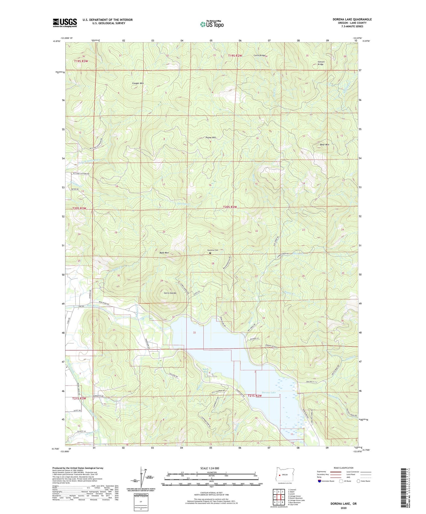
2024 topographic map quadrangle Dorena Lake in the state of Oregon. Scale: 1:24000. Based on the newly updated USGS 7.5' US Topo map series, this map is in the following counties: Lane. The map contains contour data, water features, and other items you are used to seeing on USGS maps, but also has updated roads and other features. This is the next generation of topographic maps. Printed on high-quality waterproof paper with UV fade-resistant inks.
Quads adjacent to this one:
West: Cottage Grove
Northwest: Creswell
North: Jasper
Northeast: Lowell
East: Kloster Mountain
Southeast: Culp Creek
South: Blue Mountain
Southwest: Cottage Grove Lake
This map covers the same area as the classic USGS quad with code o43122g8.
Contains the following named places: Baker, Baker Bay, Baker Bay County Park, Baker Bay Marina, Baker Bay Park Boat Ramp, Baker Creek, Bald Mountain, Bear Mountain, Bluff Creek, Cerro Gordo, Christman Post Office, Corrin, Cougar Mountain, Currin Bridge, Dinner Creek, Doolittle Cemetery, Dorena, Dorena Dam, Dorena Lake, Dorena Tree Improvement Center, Gravel Pit, Hamblen Creek, Hanns Creek, Harms Creek, Harms Park, Harms Park Boat Ramp, June Post Office, KRNN-FM, Old Slow and Easy Landing, Prune Hill, Rat Creek, Red Rock, Schwartz Park, Smith Creek, Stewart Bridge, Teeter Creek, Teeter Creek Recreational Area, Vaughn Creek