MyTopo
Creswell Oregon US Topo Map
Couldn't load pickup availability
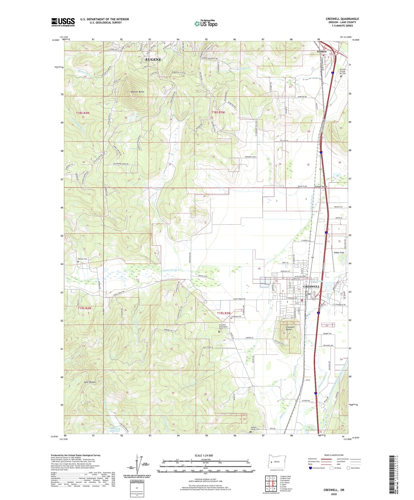
2023 topographic map quadrangle Creswell in the state of Oregon. Scale: 1:24000. Based on the newly updated USGS 7.5' US Topo map series, this map is in the following counties: Lane. The map contains contour data, water features, and other items you are used to seeing on USGS maps, but also has updated roads and other features. This is the next generation of topographic maps. Printed on high-quality waterproof paper with UV fade-resistant inks.
Quads adjacent to this one:
West: Fox Hollow
Northwest: Eugene West
North: Eugene East
Northeast: Springfield
East: Jasper
Southeast: Dorena Lake
South: Cottage Grove
Southwest: Lorane
This map covers the same area as the classic USGS quad with code o43123h1.
Contains the following named places: 52nd & Willamette Trailhead, 97426, Alvey Substation, Art House Friends Church, Camas Swale, Charlemagne at Fox Hollow French Immersion Elementary School, Church of the Nazarene, City of Creswell, Creslane Elementary School, Creswell, Creswell Association Cemetery, Creswell Butte, Creswell City Hall, Creswell Division, Creswell High School, Creswell Historical Museum, Creswell Library, Creswell Middle School, Creswell Post Office, Creswell Sheriff's Office, Creswell Wastewater Treatment Facility, Creswell Water Treatment, Dillard Skyline City Park, Fadeley Reservoir, Garden Lake, Goshen, Goshen Grange 561 Cemetery, Goshen Post Office, Goshen Rural Fire Protection District, Harry Holt Memorial Park, Hobby Field, Jackson Family Cemetery, Kinney Park, KPNW-AM, Lane Transit District Park and Ride, Mathews, Mazama Timber Pad, Moxley Cemetery, Pembrook Reservoir, Scott Creek, South Lane County Fire and Rescue Station 2 - 3, Spencer Butte, Spencer Butte Park, Stalder Slough, Tunnel Millrace, Weyerhaeuser Timber, Willamette Leadership Academy