MyTopo
Jasper Oregon US Topo Map
Couldn't load pickup availability
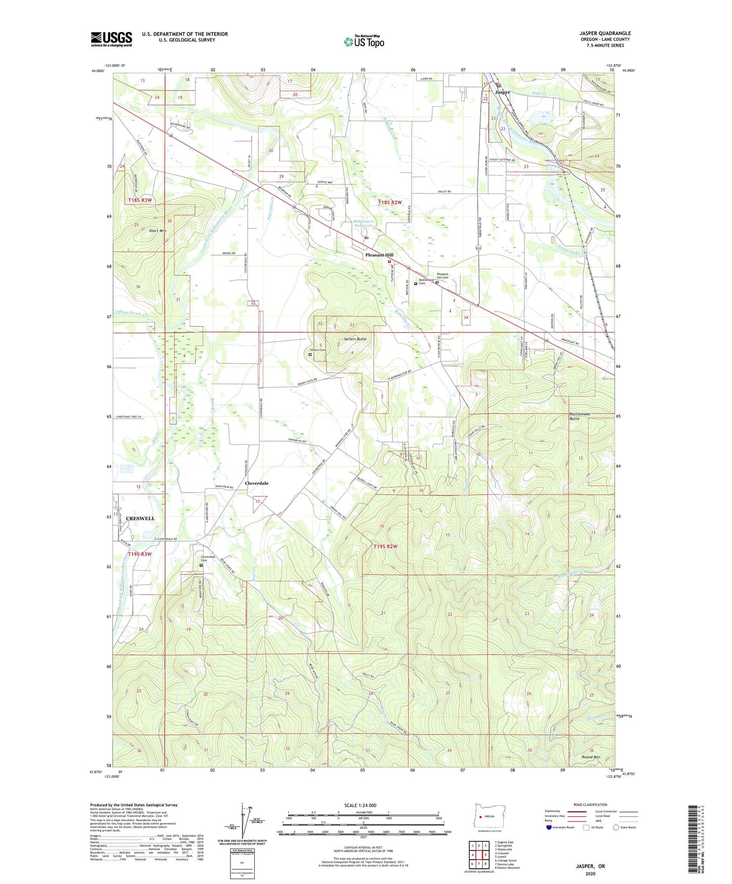
2023 topographic map quadrangle Jasper in the state of Oregon. Scale: 1:24000. Based on the newly updated USGS 7.5' US Topo map series, this map is in the following counties: Lane. The map contains contour data, water features, and other items you are used to seeing on USGS maps, but also has updated roads and other features. This is the next generation of topographic maps. Printed on high-quality waterproof paper with UV fade-resistant inks.
Quads adjacent to this one:
West: Creswell
Northwest: Eugene East
North: Springfield
Northeast: Walterville
East: Lowell
Southeast: Kloster Mountain
South: Dorena Lake
Southwest: Cottage Grove
This map covers the same area as the classic USGS quad with code o43122h8.
Contains the following named places: Alder Creek, Bear Creek, Camas Swale Creek, Cloverdale, Cloverdale Cemetery, Derr Pond, Dougren, Emerald Christian Academy, Fall Creek Junction, Hill Creek, Hills, Hills Creek, Jasper, Jasper Bridge Boat Ramp, Jasper Census Designated Place, Jasper Post Office, Jasper State Park, Lane County, Laurelwood Academy, Mulholland Cemetery, Papenfus Creek, Pleasant Hill, Pleasant Hill Cemetery, Pleasant Hill Church of Christ, Pleasant Hill Community Theatre, Pleasant Hill Division, Pleasant Hill High School, Pleasant Hill Lutheran Church, Pleasant Hill Middle School, Pleasant Hill Post Office, Pleasant Hill Volunteer Fire Protection District Station 1, Pleasant Hill Volunteer Fire Protection District Station 2, Rattlesnake Butte, Rattlesnake Creek, Robberson Reservoir, Sellers Butte, Sellers Cemetery, Short Mountain, Short Mountain Power Plant, Wild Hog Creek, ZIP Code: 97455