MyTopo
Dovre Peak Oregon US Topo Map
Couldn't load pickup availability
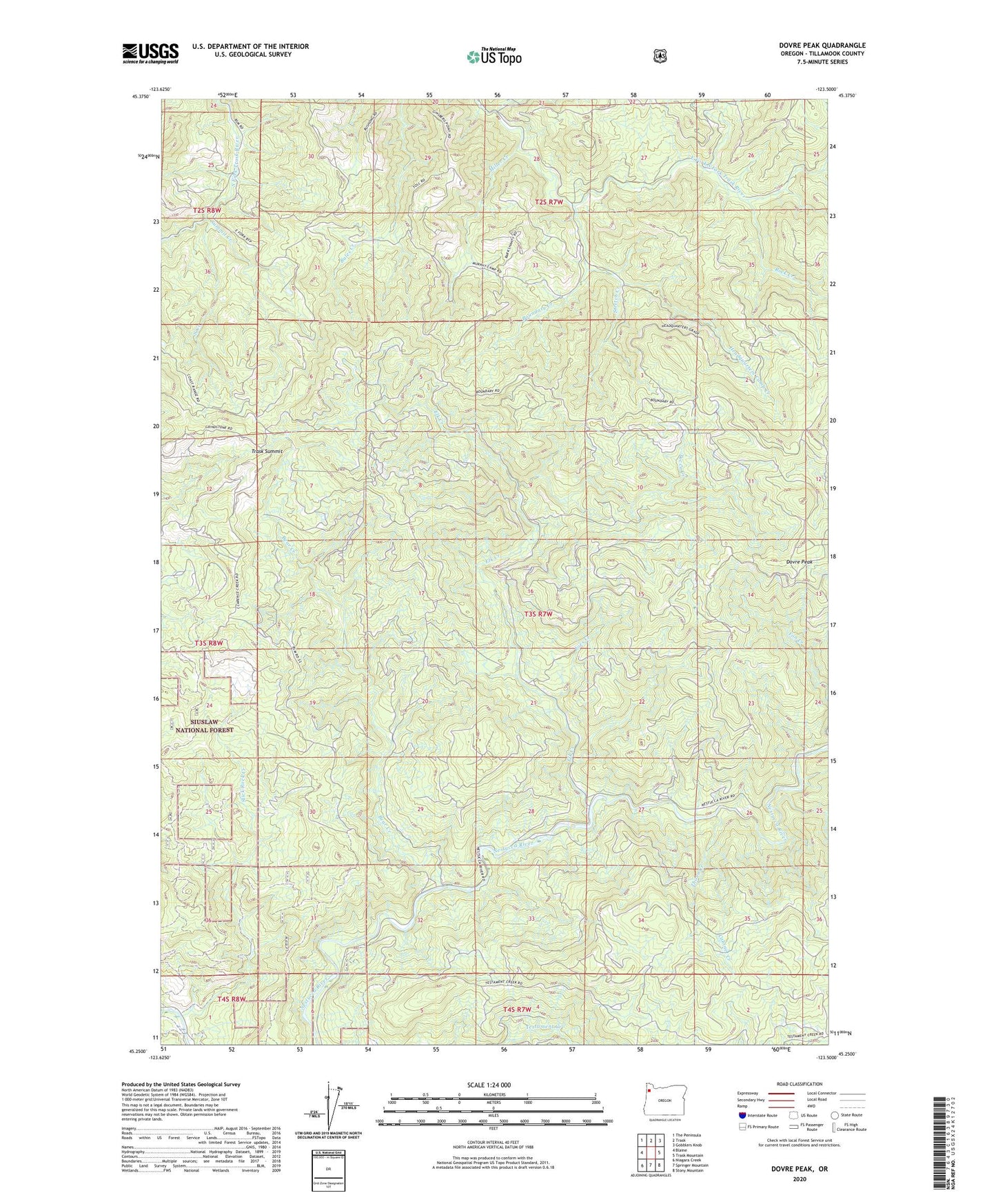
2020 topographic map quadrangle Dovre Peak in the state of Oregon. Scale: 1:24000. Based on the newly updated USGS 7.5' US Topo map series, this map is in the following counties: Tillamook. The map contains contour data, water features, and other items you are used to seeing on USGS maps, but also has updated roads and other features. This is the next generation of topographic maps. Printed on high-quality waterproof paper with UV fade-resistant inks.
Quads adjacent to this one:
West: Blaine
Northwest: The Peninsula
North: Trask
Northeast: Gobblers Knob
East: Trask Mountain
Southeast: Stony Mountain
South: Springer Mountain
Southwest: Niagara Creek
Contains the following named places: Alder Glen Campground, Bear Creek, Boundary Creek, Cabinet Creek, Dovre Peak, Elk Bend Campground, Elk Creek, Headquarters Camp Creek, Joes Creek, Mesabi Creek, Miller Creek, Murphys Camp Creek, Rock Creek, Slick Rock Creek, South Creek, Steampot Creek, Stretch Creek, Summit Creek, Thorn Creek, Trask Summit, Tucca Creek