MyTopo
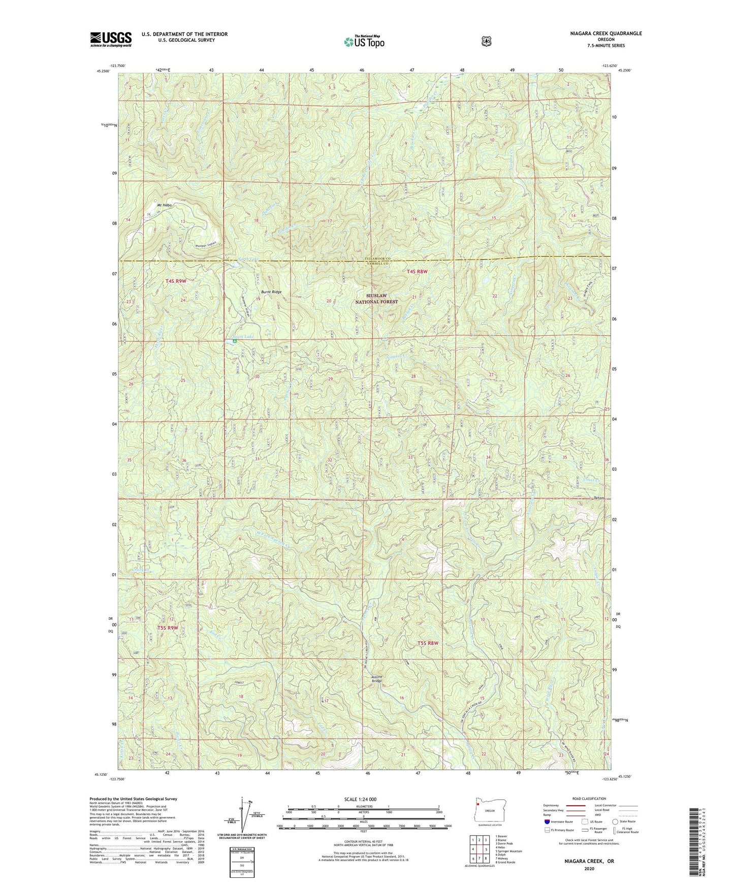
Niagara Creek Oregon US Topo Map
Couldn't load pickup availability
Also explore the Niagara Creek Forest Service Topo of this same quad for updated USFS data
2024 topographic map quadrangle Niagara Creek in the state of Oregon. Scale: 1:24000. Based on the newly updated USGS 7.5' US Topo map series, this map is in the following counties: Yamhill, Tillamook. The map contains contour data, water features, and other items you are used to seeing on USGS maps, but also has updated roads and other features. This is the next generation of topographic maps. Printed on high-quality waterproof paper with UV fade-resistant inks.
Quads adjacent to this one:
West: Hebo
Northwest: Beaver
North: Blaine
Northeast: Dovre Peak
East: Springer Mountain
Southeast: Grand Ronde
South: Midway
Southwest: Dolph
This map covers the same area as the classic USGS quad with code o45123b6.
Contains the following named places: Agency Creek Quarry, Asinine Bridge, Buelah Creek, Burnt Ridge, Dahl Fork, Grand Ronde Community, KTIL-FM, Left Branch Powder Creek, Mount Hebo, Mount Hebo Recreation Site, Niagara Creek, North Lake, Pheasant Creek, Shueble Creek, South Lake, South Lake Recreation Site, Tetons, West Fork Agency Creek, West Fork Yoncalla Creek, Yoncalla Creek