MyTopo
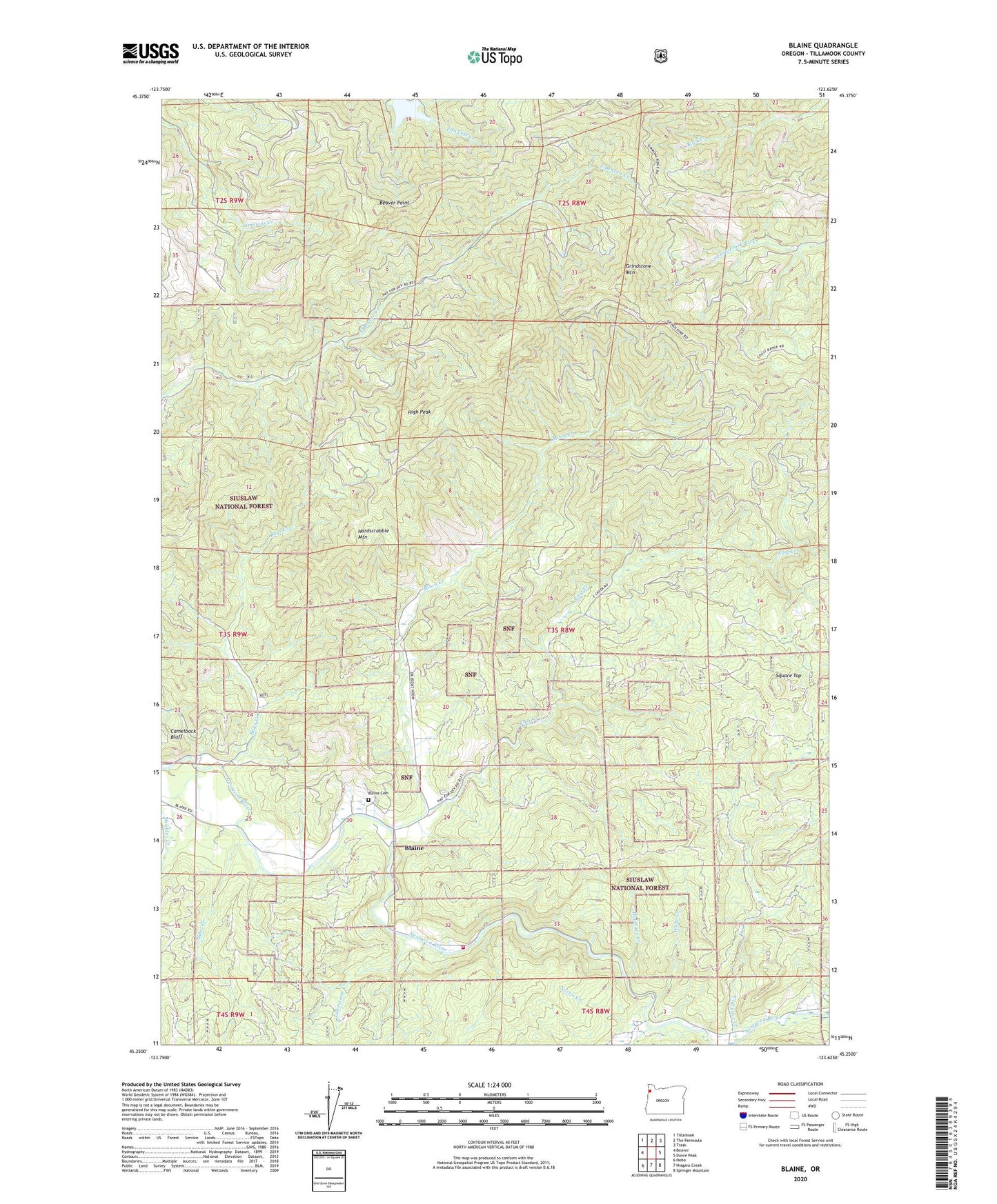
Blaine Oregon US Topo Map
Couldn't load pickup availability
Also explore the Blaine Forest Service Topo of this same quad for updated USFS data
2023 topographic map quadrangle Blaine in the state of Oregon. Scale: 1:24000. Based on the newly updated USGS 7.5' US Topo map series, this map is in the following counties: Tillamook. The map contains contour data, water features, and other items you are used to seeing on USGS maps, but also has updated roads and other features. This is the next generation of topographic maps. Printed on high-quality waterproof paper with UV fade-resistant inks.
Quads adjacent to this one:
West: Beaver
Northwest: Tillamook
North: The Peninsula
Northeast: Trask
East: Dovre Peak
Southeast: Springer Mountain
South: Niagara Creek
Southwest: Hebo
This map covers the same area as the classic USGS quad with code o45123c6.
Contains the following named places: Alder Creek, Bays Creek, Beaver Point, Blaine, Blaine Cemetery, Blaine Post Office, Camelback Bluff, Clarence Creek, Detrick Ranch, East Creek, Grindstone Mountain, Hardscrabble Mountain, Hatinger Creek, High Peak, Limestone Creek, Moon Creek, Moon Meadow Dairy, Nestucca Grange Hall, Nestucca Rural Fire Protection District Station 86 Blaine, Norris Creek, Powder Creek, Powder Creek Trail, Skookum Lake, Skookum Lake Dam, Square Top, Wake Creek, ZIP Code: 97108