MyTopo
Ferguson Mountain Oregon US Topo Map
Couldn't load pickup availability
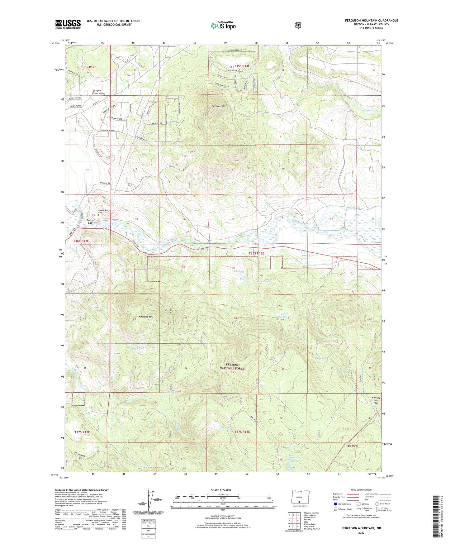
2020 topographic map quadrangle Ferguson Mountain in the state of Oregon. Scale: 1:24000. Based on the newly updated USGS 7.5' US Topo map series, this map is in the following counties: Klamath. The map contains contour data, water features, and other items you are used to seeing on USGS maps, but also has updated roads and other features. This is the next generation of topographic maps. Printed on high-quality waterproof paper with UV fade-resistant inks.
Quads adjacent to this one:
West: Beatty
Northwest: Spodue Mountain
North: Ponina Butte
Northeast: Rodeo Butte
East: Bly
Southeast: Horsefly Mountain
South: Dry Prairie
Southwest: Yainax Butte
Contains the following named places: Aspirin Pond, Beatty Gap, Bly Ridge, Coke Pond, Eagle Spring, Fawn Spring, Ferguson Mountain, Flu Pond, Kesterson Spur, Masekesket Cemetery, Medicine Mountain, Mineral Creek, Pill Pond, Rum Pond, Sprague River Valley, Spring Creek, Sycan Siding, Sycan Siding Trailhead, Upper Manhattan Spring, Witch Drain Pond