MyTopo
Five Rivers Oregon US Topo Map
Couldn't load pickup availability
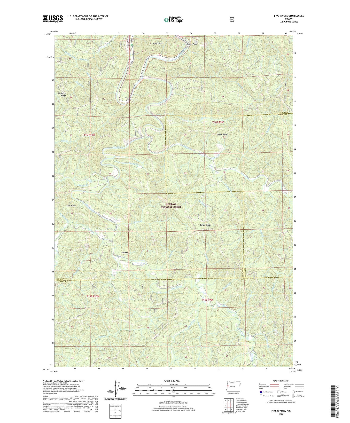
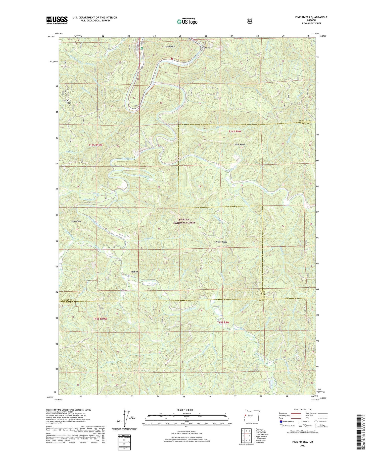
2020 topographic map quadrangle Five Rivers in the state of Oregon. Scale: 1:24000. Based on the newly updated USGS 7.5' US Topo map series, this map is in the following counties: Lincoln, Lane, Benton. The map contains contour data, water features, and other items you are used to seeing on USGS maps, but also has updated roads and other features. This is the next generation of topographic maps. Printed on high-quality waterproof paper with UV fade-resistant inks.
Quads adjacent to this one:
West: Cannibal Mountain
Northwest: Tidewater
North: Hellion Rapids
Northeast: Grass Mountain
East: Digger Mountain
Southeast: Windy Peak
South: Herman Creek
Southwest: Cummins Peak
Contains the following named places: Alder Creek, Bear Creek, Blackberry Park Boat Launch, Blackberry Recreation Site, Buck Creek, Camp Creek, Cascade Creek, Cascade Falls, Cedar Creek, Central Oregon Coast Fire and Rescue District 7 Station 7400, Cherry Creek, Cougar Creek, Crab Creek, Crazy Creek, Crooked Creek, Denzer, Denzer Bridge, Denzer Post Office, Denzer Ridge, Elk Creek, Fendall Creek, Fisher, Fisher Post Office, Five Rivers, Five Rivers County Park, Five Rivers Launch, Fleece Ridge, George Creek, Green River, Hoover Creek, Lake Creek, Launching Forest Camp Boat Launch, Lobster Creek, Malcolm Ridge, Maples Forest Camp, McDonald Creek, McGlynn Creek, Meadow Fork, National Forest Land Park, North Fork Cascade Creek, Paris, Paris Post Office, Phillips Creek, Pitchfork Ridge, Ryan Creek, Stoney Point, Stoney Point Boat Launch, Summers Creek, Swamp Creek, Taylor Creek, Vernon Post Office, ZIP Code: 97390