MyTopo
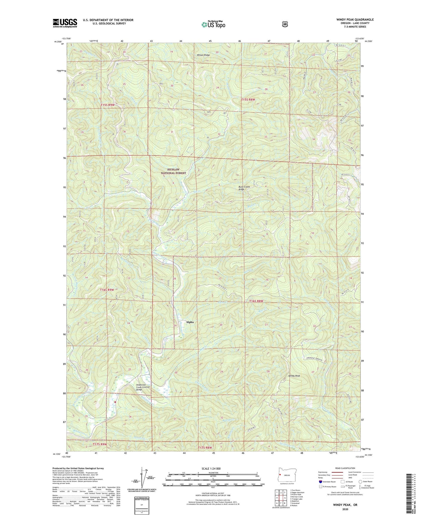
Windy Peak Oregon US Topo Map
Couldn't load pickup availability
Also explore the Windy Peak Forest Service Topo of this same quad for updated USFS data
2023 topographic map quadrangle Windy Peak in the state of Oregon. Scale: 1:24000. Based on the newly updated USGS 7.5' US Topo map series, this map is in the following counties: Lane. The map contains contour data, water features, and other items you are used to seeing on USGS maps, but also has updated roads and other features. This is the next generation of topographic maps. Printed on high-quality waterproof paper with UV fade-resistant inks.
Quads adjacent to this one:
West: Herman Creek
Northwest: Five Rivers
North: Digger Mountain
Northeast: Prairie Peak
East: Triangle Lake
Southeast: Walton
South: Greenleaf
Southwest: Mapleton
This map covers the same area as the classic USGS quad with code o44123b6.
Contains the following named places: Alpha, Alpha Creek, Alpha Post Office, Bear Creek, Buck Creek, Buck Creek Ridge, Deadwood Creek Covered Bridge, Deadwood School, Deer Creek, East Fork Lobster Creek, Elk Creek, Fawn Creek, Karlstrom Creek, North Fork Panther Creek, Panther Creek, Raleigh Creek, Rock Creek, South Fork Bear Creek, Swartz Creek, Swisshome - Deadwood Rural Fire Protection District, West Fork Deadwood Creek, Windy Peak, ZIP Code: 97430