MyTopo
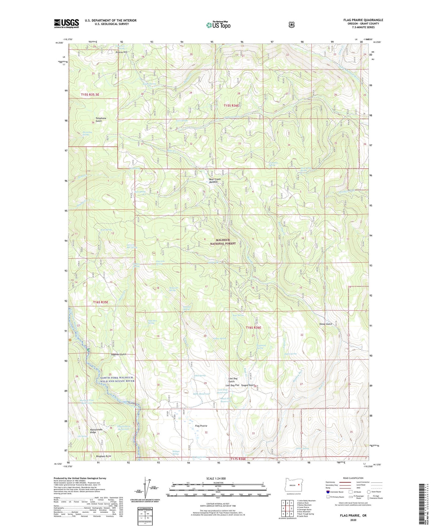
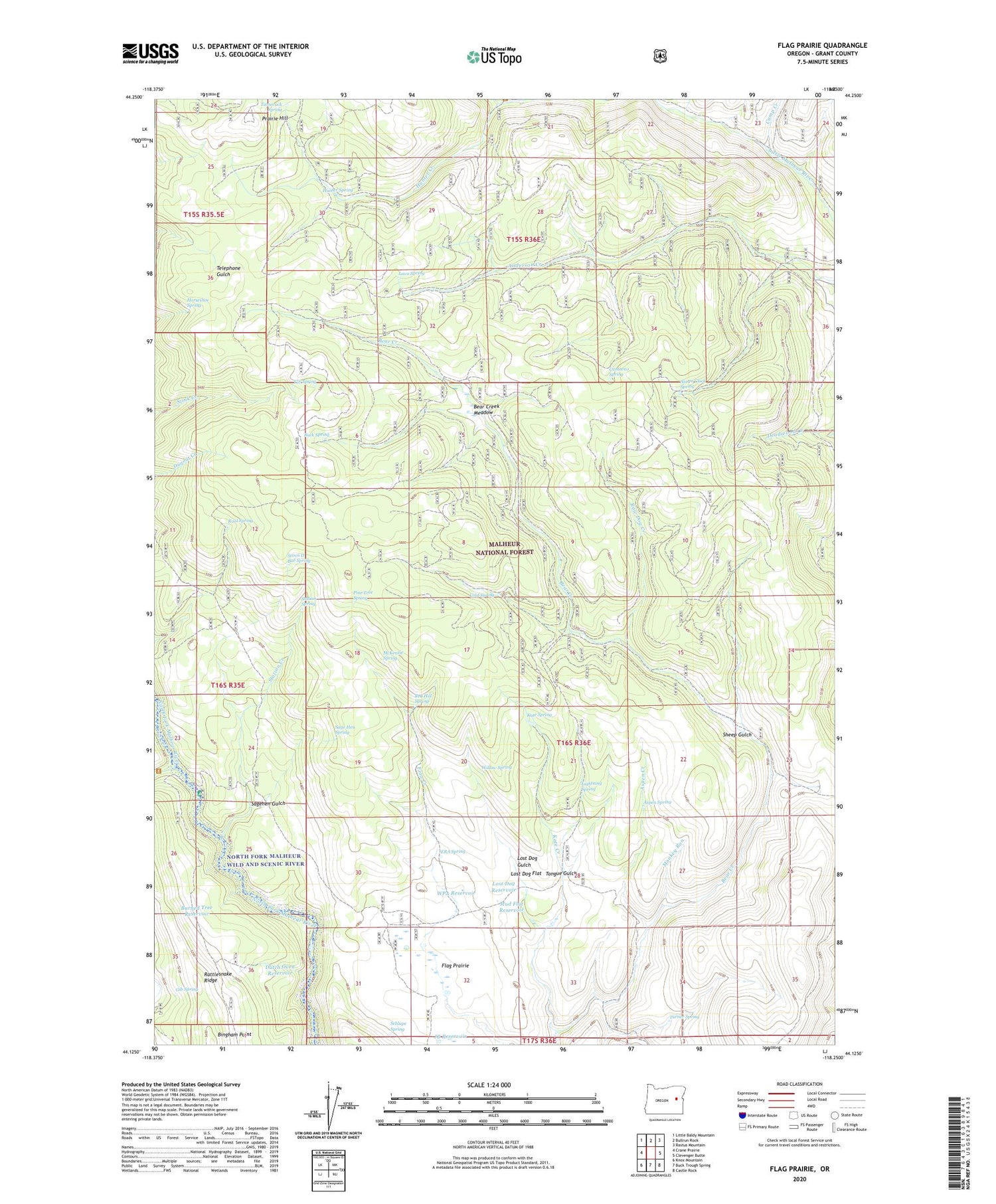
Flag Prairie Oregon US Topo Map
Couldn't load pickup availability
2020 topographic map quadrangle Flag Prairie in the state of Oregon. Scale: 1:24000. Based on the newly updated USGS 7.5' US Topo map series, this map is in the following counties: Grant. The map contains contour data, water features, and other items you are used to seeing on USGS maps, but also has updated roads and other features. This is the next generation of topographic maps. Printed on high-quality waterproof paper with UV fade-resistant inks.
Quads adjacent to this one:
West: Crane Prairie
Northwest: Little Baldy Mountain
North: Bullrun Rock
Northeast: Rastus Mountain
East: Clevenger Butte
Southeast: Castle Rock
South: Buck Trough Spring
Southwest: Knox Mountain
Contains the following named places: Alarm Clock Spring, Aspen Creek, Aspen Spring, Bear Creek Meadow, Bingham Point, Buck Spring, Burned Tree Reservoir, Camp Creek, Canteen Creek, Canteeno Spring, Cold Spring, Crane Creek, Crane Creek Campground, Dutch Oven Reservoir, ERA Spring, Flag Prairie, Flag Prairie Cow Camp, Gib Spring, Horseshoe Spring, Hunter Creek, Hunter Spring, JB Reservoir, Kate Creek, Kate Spring, Lava Spring, Lightning Spring, Little Malheur River Recreation Site, Lost Dog Flat, Lost Dog Gulch, Lost Dog Reservoir, McKenzie Spring, Monkey Run Creek, Mud Flat Reservoir, Pine Tree Spring, Prairie Hill, Rattlesnake Ridge, Raw Dog Creek, Red Hill Spring, Root Spring, Sage Hen Spring, Sagehen Gulch, Schlupe Spring, Seven D Bar Spring, Sheep Gulch, Slate Gulch, Station Creek, Station Spring, Tamarack Spring, Tongue Gulch, Tub Spring, Turner Spring, Willow Spring, WPA Reservoir