MyTopo
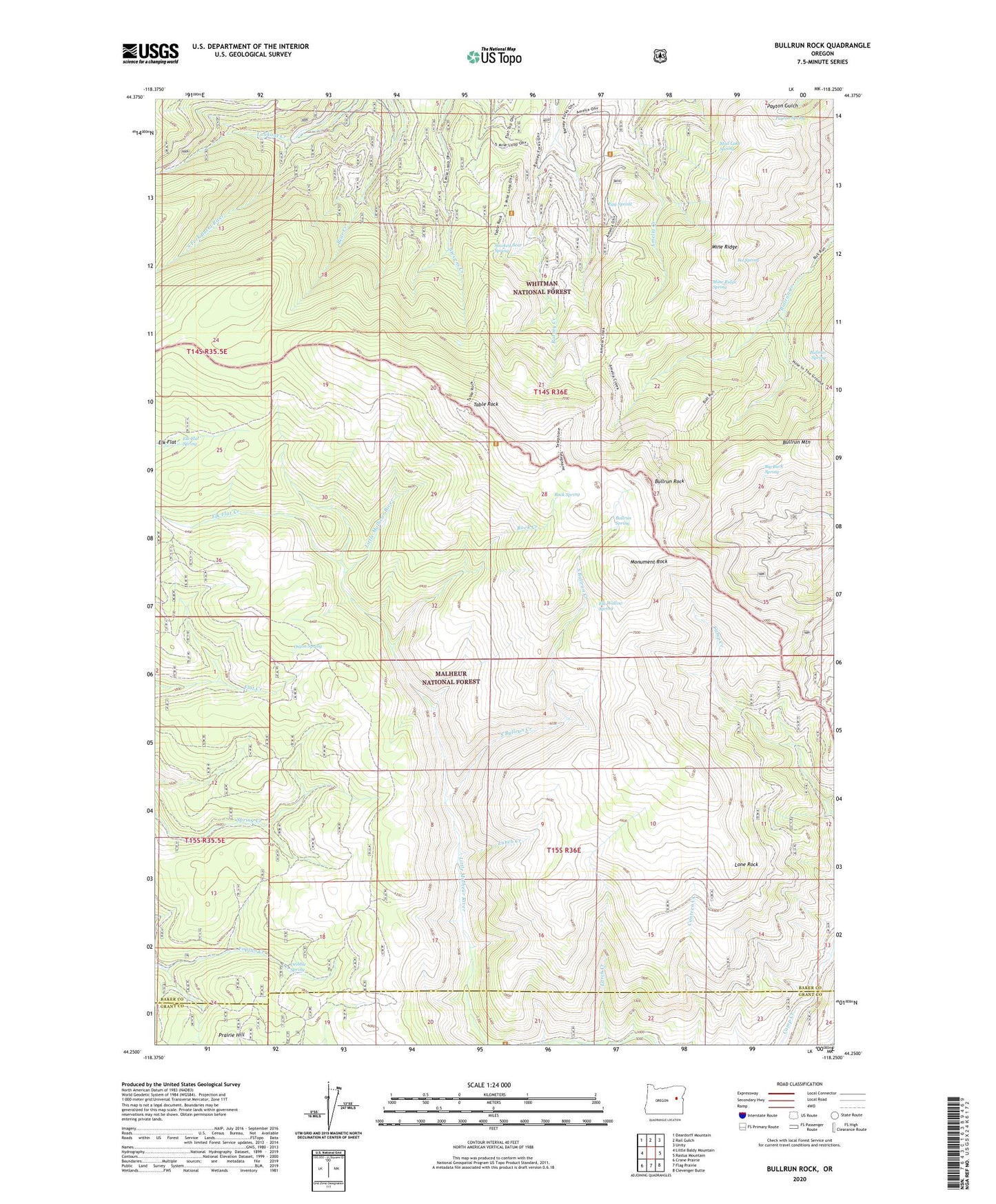
Bullrun Rock Oregon US Topo Map
Couldn't load pickup availability
Also explore the Bullrun Rock Forest Service Topo of this same quad for updated USFS data
2024 topographic map quadrangle Bullrun Rock in the state of Oregon. Scale: 1:24000. Based on the newly updated USGS 7.5' US Topo map series, this map is in the following counties: Baker, Grant. The map contains contour data, water features, and other items you are used to seeing on USGS maps, but also has updated roads and other features. This is the next generation of topographic maps. Printed on high-quality waterproof paper with UV fade-resistant inks.
Quads adjacent to this one:
West: Little Baldy Mountain
Northwest: Deardorff Mountain
North: Rail Gulch
Northeast: Unity
East: Rastus Mountain
Southeast: Clevenger Butte
South: Flag Prairie
Southwest: Crane Prairie
This map covers the same area as the classic USGS quad with code o44118c3.
Contains the following named places: Amelia Trailhead, Big Buck Spring, Bullrun Rock, Bullrun Spring, Dribble Spring, Egg Spring, Elk Flat Creek, Elk Flat Spring, Elk Wallow Spring, Ike Spring, Larch Creek, Lone Rock, Lookout Creek, Lunch Creek, Mine Ridge, Mine Ridge Spring, Monument Rock, Monument Rock Wilderness, Mud Lake Spring, Onion Spring, Payton Spring, Rock Creek, Rock Spring, Smokey Bear Spring, South Bullrun Creek, Table Rock, Table Rock Fire Lookout Tower, Table Rock Trailhead