MyTopo
Little Baldy Mountain Oregon US Topo Map
Couldn't load pickup availability
Also explore the Little Baldy Mountain Forest Service Topo of this same quad for updated USFS data
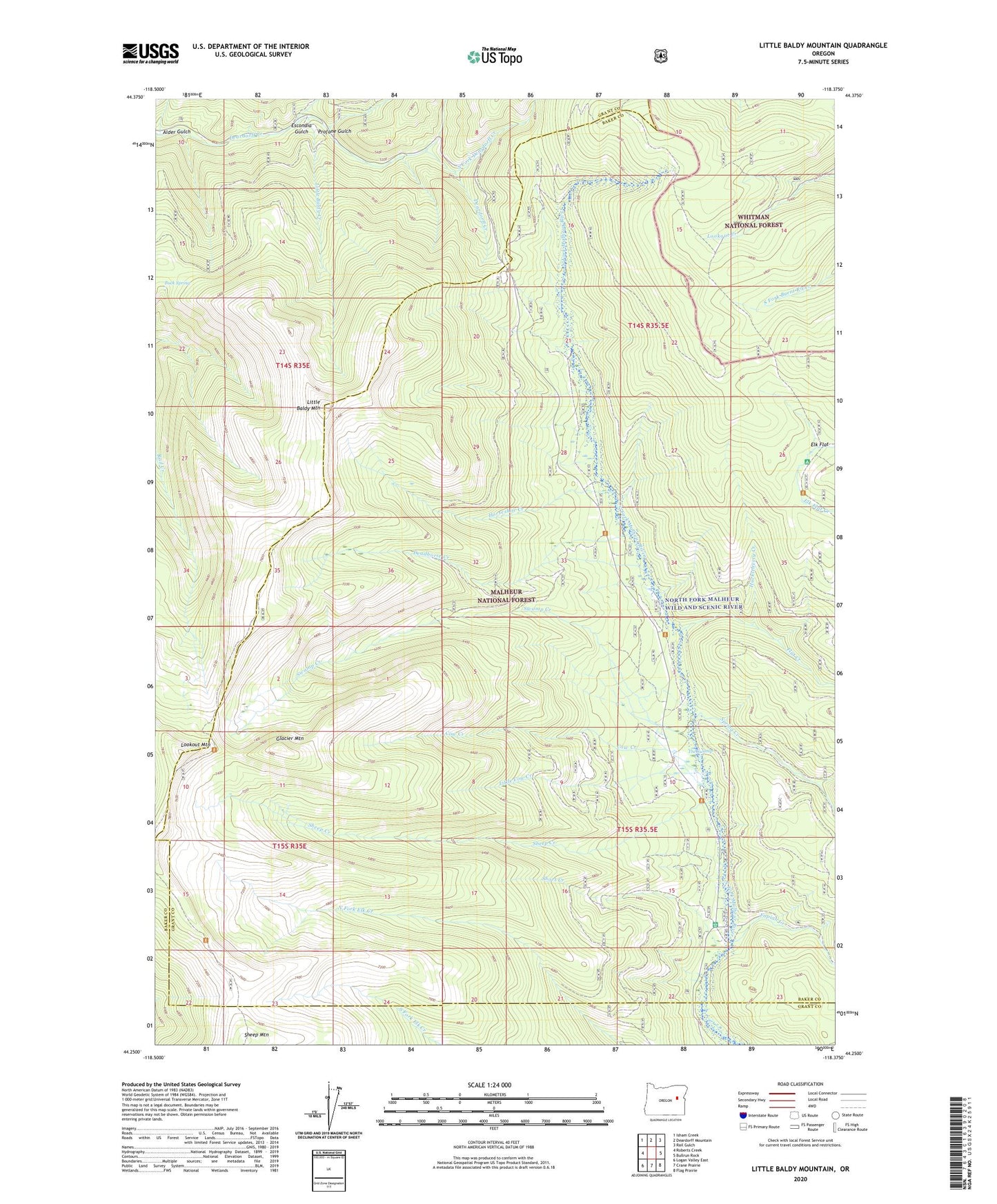
2024 topographic map quadrangle Little Baldy Mountain in the state of Oregon. Scale: 1:24000. Based on the newly updated USGS 7.5' US Topo map series, this map is in the following counties: Baker, Grant. The map contains contour data, water features, and other items you are used to seeing on USGS maps, but also has updated roads and other features. This is the next generation of topographic maps. Printed on high-quality waterproof paper with UV fade-resistant inks.
Quads adjacent to this one:
West: Roberts Creek
Northwest: Isham Creek
North: Deardorff Mountain
Northeast: Rail Gulch
East: Bullrun Rock
Southeast: Flag Prairie
South: Crane Prairie
Southwest: Logan Valley East
This map covers the same area as the classic USGS quad with code o44118c4.
Contains the following named places: Alder Gulch, Big Cow Burn, Buck Spring, Cow Creek, Deadhorse Creek, Elk Flat, Escondia Gulch, Flat Creek, Fopian Campground, Fopian Creek, Glacier Mountain, Horseshoe Creek, Huckleberry Creek, Little Baldy Creek, Little Baldy Mountain, Little Baldy Trail, Little Cow Creek, Lookout Mountain, North Fork Deardorff Creek, Profane Gulch, Sheep Creek, Sheep Mountain, Short Creek, Short Creek Forest Service Station, South Fork Deardorff Creek, Spring Creek, Starvation Trail, Sunshine Flat Trail, Swamp Creek, The Swamp