
MyTopo
French Mountain Oregon US Topo Map
Couldn't load pickup availability
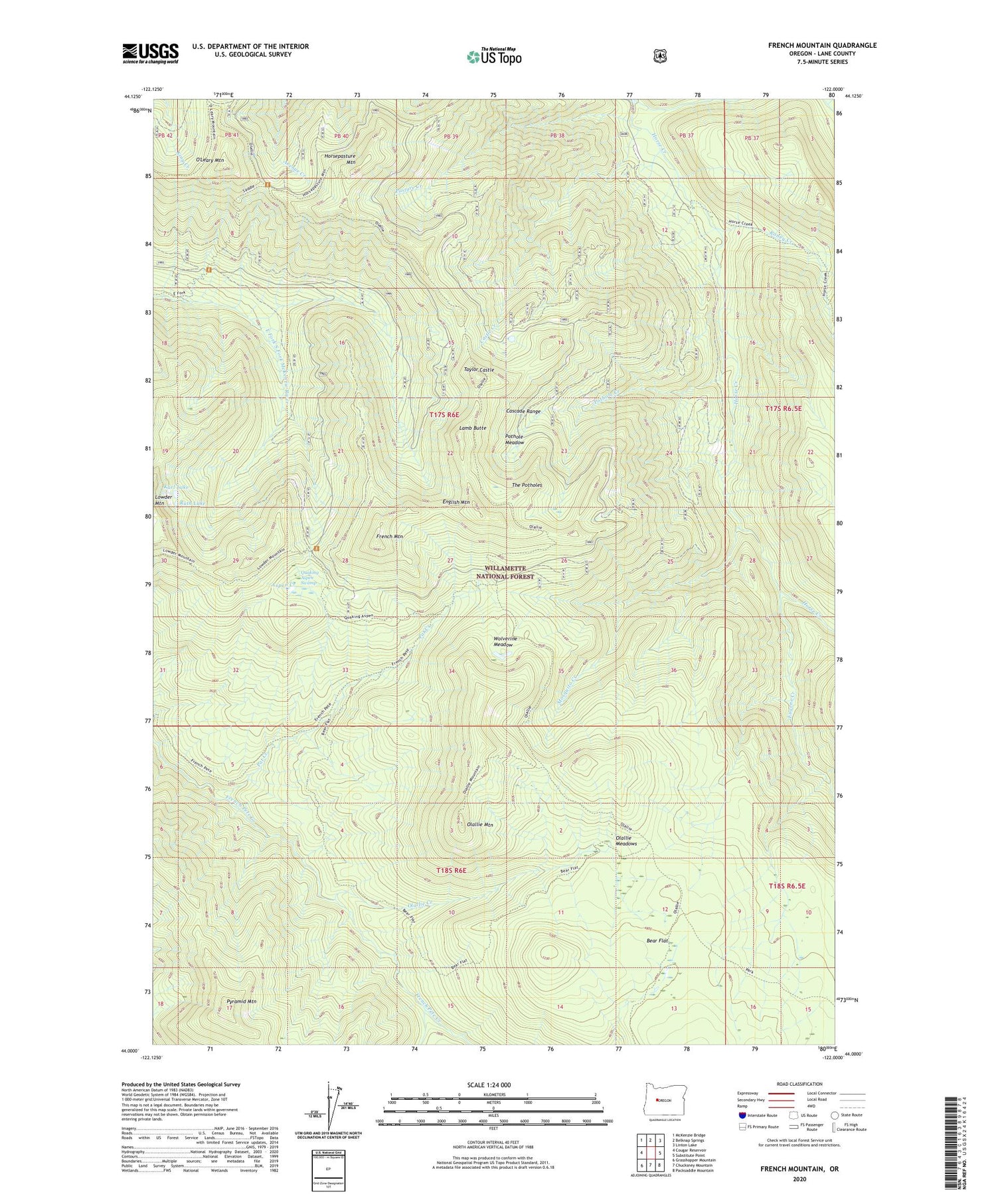
2020 topographic map quadrangle French Mountain in the state of Oregon. Scale: 1:24000. Based on the newly updated USGS 7.5' US Topo map series, this map is in the following counties: Lane. The map contains contour data, water features, and other items you are used to seeing on USGS maps, but also has updated roads and other features. This is the next generation of topographic maps. Printed on high-quality waterproof paper with UV fade-resistant inks.
Quads adjacent to this one:
West: Cougar Reservoir
Northwest: McKenzie Bridge
North: Belknap Springs
Northeast: Linton Lake
East: Substitute Point
Southeast: Packsaddle Mountain
South: Chucksney Mountain
Southwest: Grasshopper Mountain
Contains the following named places: Aspen Creek, Bear Flat, Castle Creek, English Mountain, Eugene Creek, French Mountain, Horsepasture Mountain, Horsepasture Pass Shelter, Karl Lake, Lamb Butte, Louise Creek, Mosquito Creek, Olallie Creek, Olallie Guard Station, Olallie Meadows, Olallie Mountain, Olallie Trail, O'Leary Mountain, Pasture Creek, Pat Creek, Pothole Creek, Pothole Meadow, Pyramid Mountain, Pyramid Trail, Quaking Aspen Swamp, Roney Creek, Ruth Lake, Saddle Trail, Separation Creek, Taylor Castle, The Potholes, Wolverine Meadow, ZIP Code: 97413


