MyTopo
Stayton NE Oregon US Topo Map
Couldn't load pickup availability
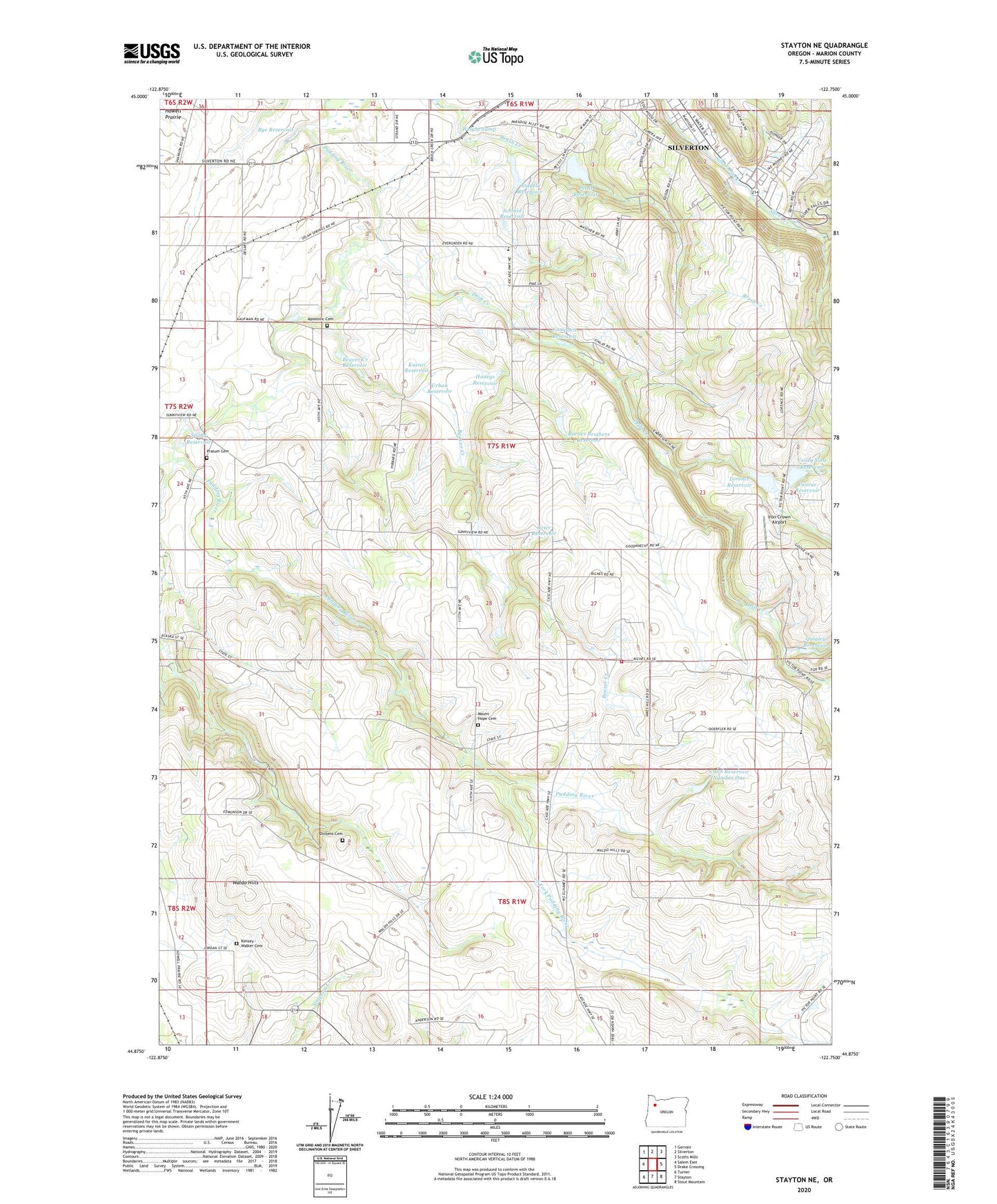
2024 topographic map quadrangle Stayton NE in the state of Oregon. Scale: 1:24000. Based on the newly updated USGS 7.5' US Topo map series, this map is in the following counties: Marion. The map contains contour data, water features, and other items you are used to seeing on USGS maps, but also has updated roads and other features. This is the next generation of topographic maps. Printed on high-quality waterproof paper with UV fade-resistant inks.
Quads adjacent to this one:
West: Salem East
Northwest: Gervais
North: Silverton
Northeast: Scotts Mills
East: Drake Crossing
Southeast: Stout Mountain
South: Stayton
Southwest: Turner
This map covers the same area as the classic USGS quad with code o44122h7.
Contains the following named places: Apostolic Cemetery, Barnes Brothers Reservoir, Barnes Brothers Reservoir Dam, Beaver Creek, Beaver Creek Reservoir, Bye Reservoir, Campbell Reservoir, Clymer, Clymer Post Office, Dickens Cemetery, Drift Creek, Evergreen Elementary School, Funrue Dam, Funrue Reservoir, Grier Reservoir, Howell Prairie, Hunegs Reservoir, Iron Crown Airport, Johnsons Mill, Kimsey - Walker Cemetery, Kuenzi Reservoir, Lebanon Post Office, Lorence Dam, Lorence Reservoir, McAlpin School, Millford, Mount Hope Cemetery, Oregon Garden Amphitheatre, Pettit Dam, Pettit Reservoir, Pratum Cemetery, Quigley Reservoir, Rogers Wayside County Park, S M S Dam Number 1, S M S Reservoir Number One, Scandia, Schmid Reservoir, Selah, Silver Creek Post Office, Silverton Rural Fire Protection District Victor Point Station 2, South Fork Pudding River, Spady Reservoir, Stadeli Reservoir, Switzerland, Switzerland Post Office, Urban Reservoir, Valley View Reservoir, Valley View School, Victor Point Elementary School, Waldo Hills, Waldo Hills Grange Hall, Willard, Willard Post Office, Wright Sump