MyTopo
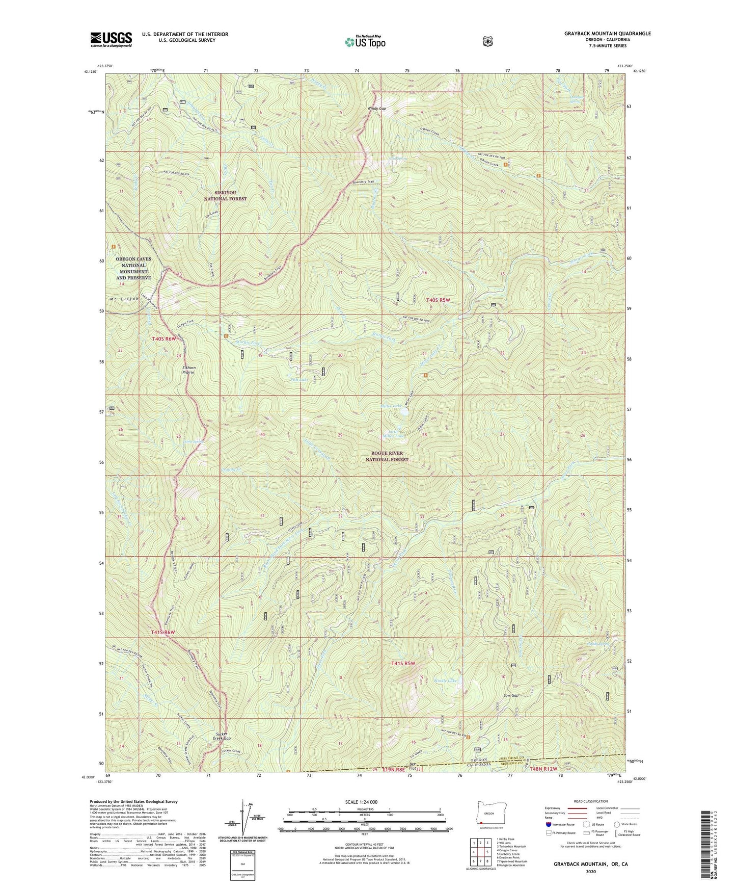
Grayback Mountain Oregon US Topo Map
Couldn't load pickup availability
Also explore the Grayback Mountain Forest Service Topo of this same quad for updated USFS data
2024 topographic map quadrangle Grayback Mountain in the states of Oregon, California. Scale: 1:24000. Based on the newly updated USGS 7.5' US Topo map series, this map is in the following counties: Josephine, Siskiyou. The map contains contour data, water features, and other items you are used to seeing on USGS maps, but also has updated roads and other features. This is the next generation of topographic maps. Printed on high-quality waterproof paper with UV fade-resistant inks.
Quads adjacent to this one:
West: Oregon Caves
Northwest: Kerby Peak
North: Williams
Northeast: Tallowbox Mountain
East: Carberry Creek
Southeast: Kangaroo Mountain
South: Figurehead Mountain
Southwest: Deadman Point
This map covers the same area as the classic USGS quad with code o42123a3.
Contains the following named places: Arnold Mine, Arnold Mountain, Bee Flat, Big Sugarloaf Peak, Bigelow Cabins, Bigelow Creek, Browntown, Cold Spring, Craggy Creek, Craggy Mountain, Deer Creek, Denman Cabin, Elk Creek, Elkhorn Prairie, Fan Creek, Fish Lake, Fosters Temple, Grayback Mountain, Grayback Shelter, Green Valley, Green Valley Trail, Grizzly Camp, Hinkle Lake, Horse Spring, Horse Spring Camp, Kendall Cabin, Klamath Mountains, Krause Cabin, Lake Mountain, Larkspur Spring, Lewis Creek, Little Craggy Creek, Little Craggy Peak, Little Creek, Little Miller Lake, Low Gap, Low Gap Creek, Low Gap Trail, Miller Lake, Miller Lake Creek, Miller Lake Dam, Mount Elijah, Mountain View Mine, O'Connell Creek, Pine Gulch, Right Hand Fork Steve Fork, Steve Fork Trail, Steve Peak, Sucker Creek Gap, Sucker Creek Shelter, Swan Mountain, Swan Valley, Whisky Peak, Whisky Ridge, Whisky Spring, Windy Gap