MyTopo
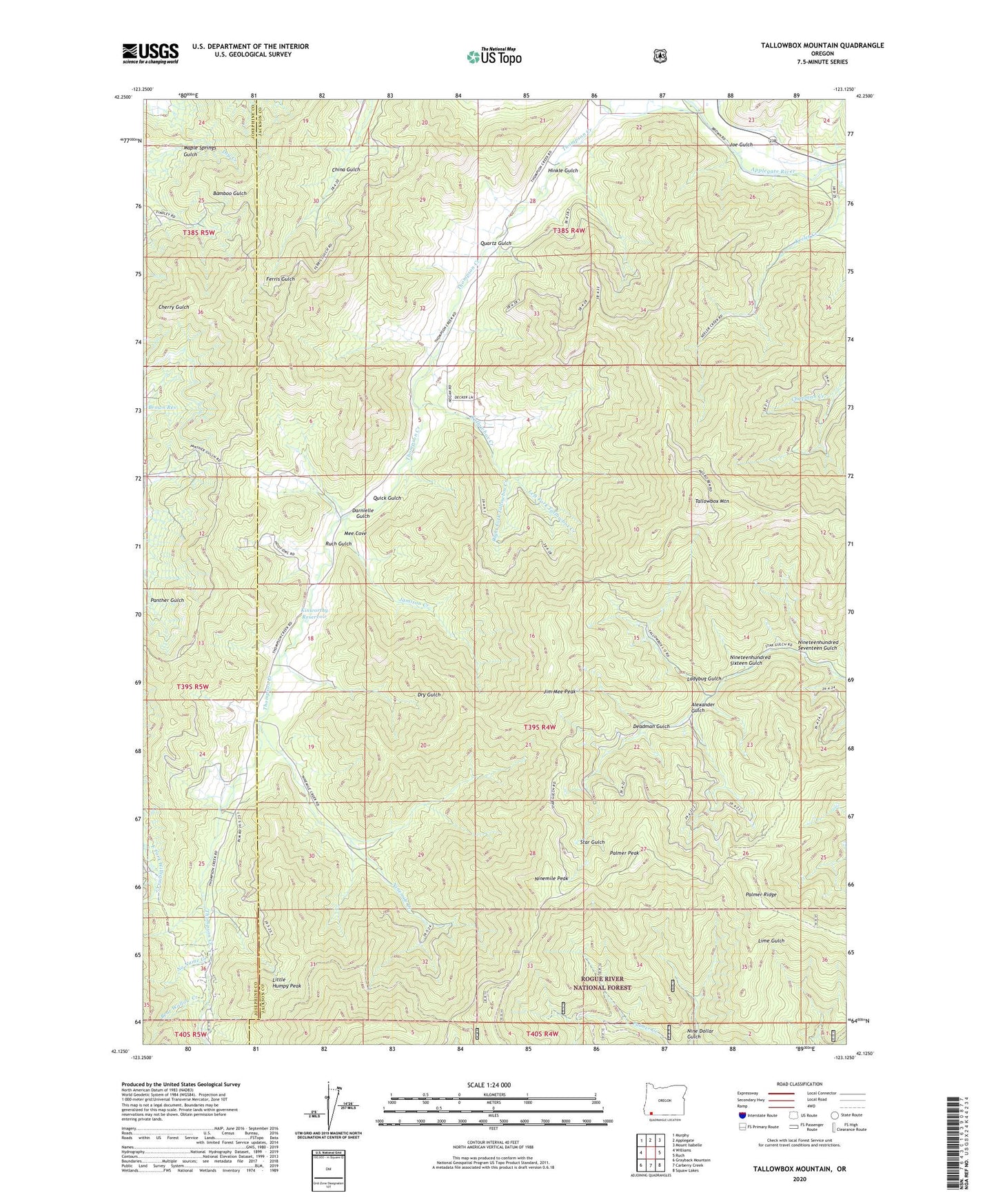
Tallowbox Mountain Oregon US Topo Map
Couldn't load pickup availability
Also explore the Tallowbox Mountain Forest Service Topo of this same quad for updated USFS data
2023 topographic map quadrangle Tallowbox Mountain in the state of Oregon. Scale: 1:24000. Based on the newly updated USGS 7.5' US Topo map series, this map is in the following counties: Jackson, Josephine. The map contains contour data, water features, and other items you are used to seeing on USGS maps, but also has updated roads and other features. This is the next generation of topographic maps. Printed on high-quality waterproof paper with UV fade-resistant inks.
Quads adjacent to this one:
West: Williams
Northwest: Murphy
North: Applegate
Northeast: Mount Isabelle
East: Ruch
Southeast: Squaw Lakes
South: Carberry Creek
Southwest: Grayback Mountain
This map covers the same area as the classic USGS quad with code o42123b2.
Contains the following named places: Alexander Gulch, Baltimore Ditch, Bear Wallow Creek, Bingham, Bone of Contention Mine, Brown Res, China Gulch, Darnielle Gulch, Deadman Gulch, Dry Gulch, Gibson Reservoir, Hinkle Gulch, Jamison Creek, Jim Mee Peak, Joe Gulch, Keeler Creek, Kinworthy Reservoir, Ladybug Gulch, Layton Mine, Left Fork Tallowbox Creek, Little Humpy Peak, Maid of the Mist Mine, Mee Cove, Ninemile Creek, Ninemile Peak, Nineteenhundred Seventeen Gulch, Nineteenhundred Sixteen Gulch, No Name Creek, Palmer Peak, Palmer Ridge, Quartz Gulch, Quick Gulch, Right Fork Tallowbox Creek, Ruch Gulch, Star Gulch Recreation Site, Star Gulch Sulphur Camp, Star Mine, Tallowbox Creek, Tallowbox Mountain, Thompson Creek Guard Station