
MyTopo
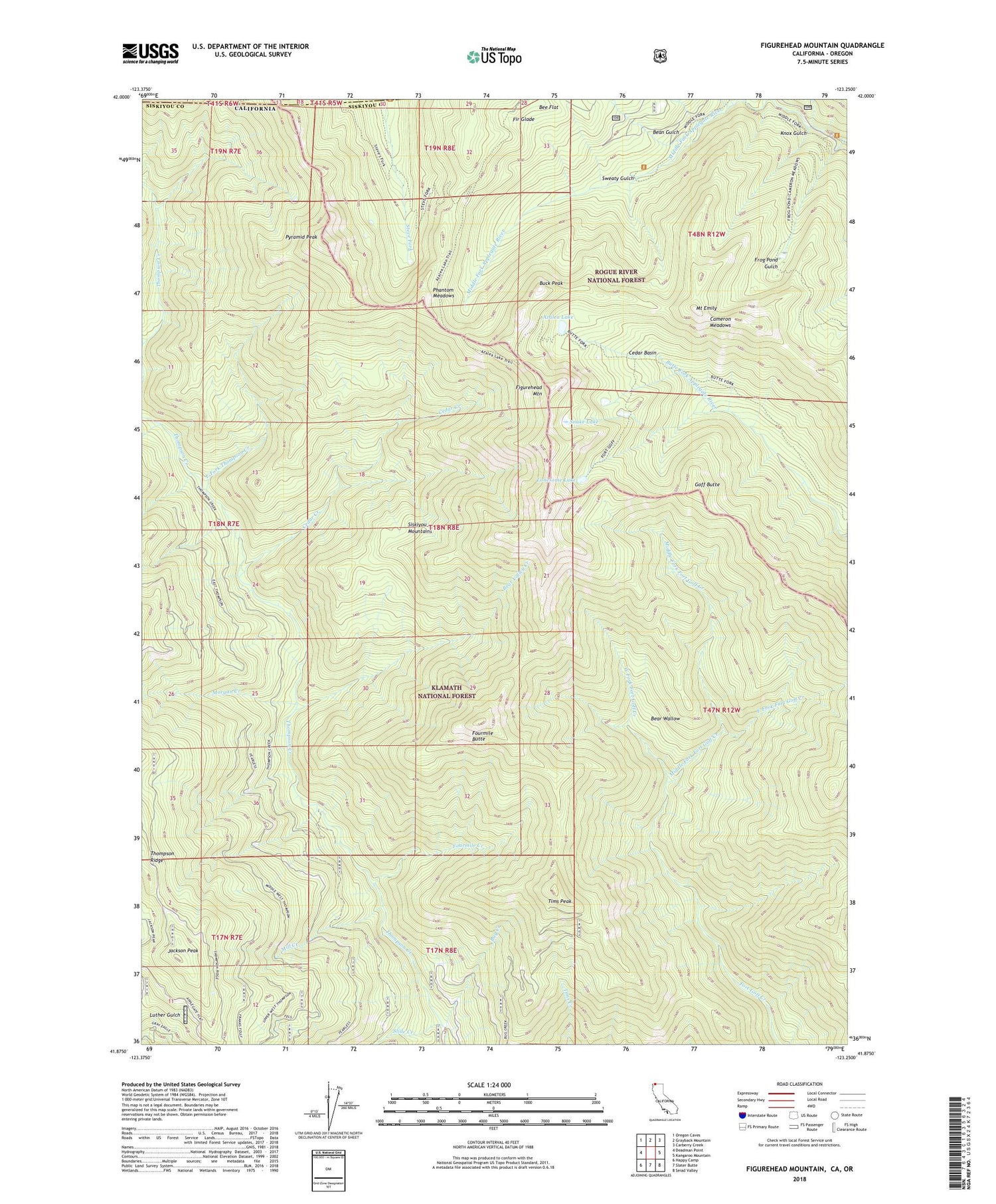
Figurehead Mountain California US Topo Map
Couldn't load pickup availability
Also explore the Figurehead Mountain Forest Service Topo of this same quad for updated USFS data
2022 topographic map quadrangle Figurehead Mountain in the state of California. Scale: 1:24000. Based on the newly updated USGS 7.5' US Topo map series, this map is in the following counties: Siskiyou, Josephine. The map contains contour data, water features, and other items you are used to seeing on USGS maps, but also has updated roads and other features. This is the next generation of topographic maps. Printed on high-quality waterproof paper with UV fade-resistant inks.
Quads adjacent to this one:
West: Deadman Point
Northwest: Oregon Caves
North: Grayback Mountain
Northeast: Carberry Creek
East: Kangaroo Mountain
Southeast: Seiad Valley
South: Slater Butte
Southwest: Happy Camp
Contains the following named places: Azalea Lake, Baileys Cabin, Bean Gulch, Bear Valley Creek, Bear Wallow, Bear Wallow Camp, Big Camp, Bill Fruit Trail, Boundary National Recreation Trail, Buck Peak, Bug Creek, Cameron Meadows, Camp Gulch, Cedar Basin, Cedar Creek, East Fork Fort Goff Creek, East Fork Thompson Creek, Figurehead Mountain, Fir Glade, Fourmile Butte, Fourmile Creek, Frog Pond Gulch, Goff Butte, Jackson Peak, Knox Gulch, Lonesome Lake, Middle Fork Fort Goff Creek, Mill Creek, Morgan Creek, Mount Emily, North Fork Camp, Phantom Meadows, Pyramid Peak, Red Buttes Wilderness, Rhodonite Mine, Slide Creek, Snake Lake, Sugar Pine Camp, Sweaty Gulch, Tims Peak, West Fork Fort Goff Creek, ZIP Code: 96086


