MyTopo
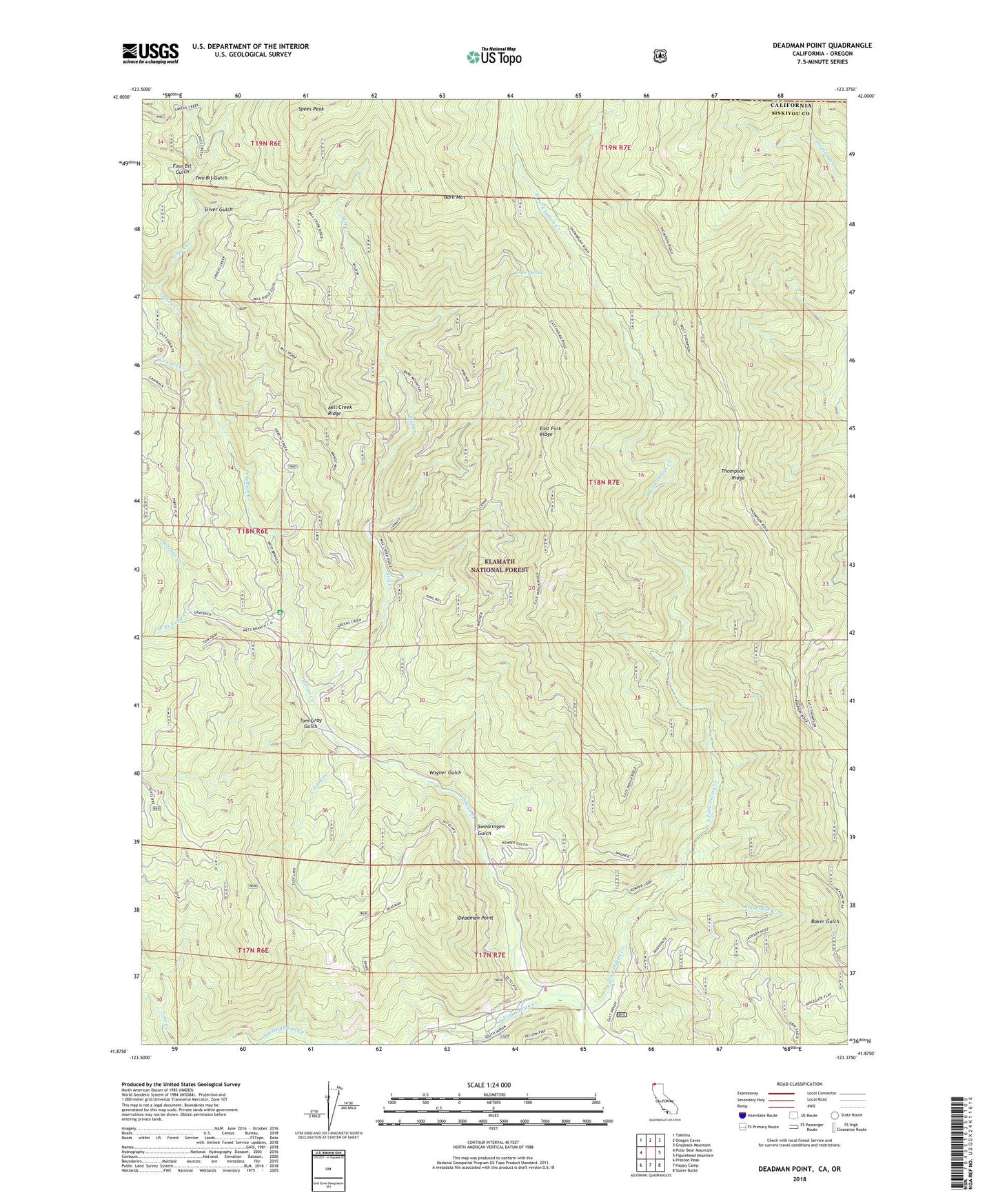
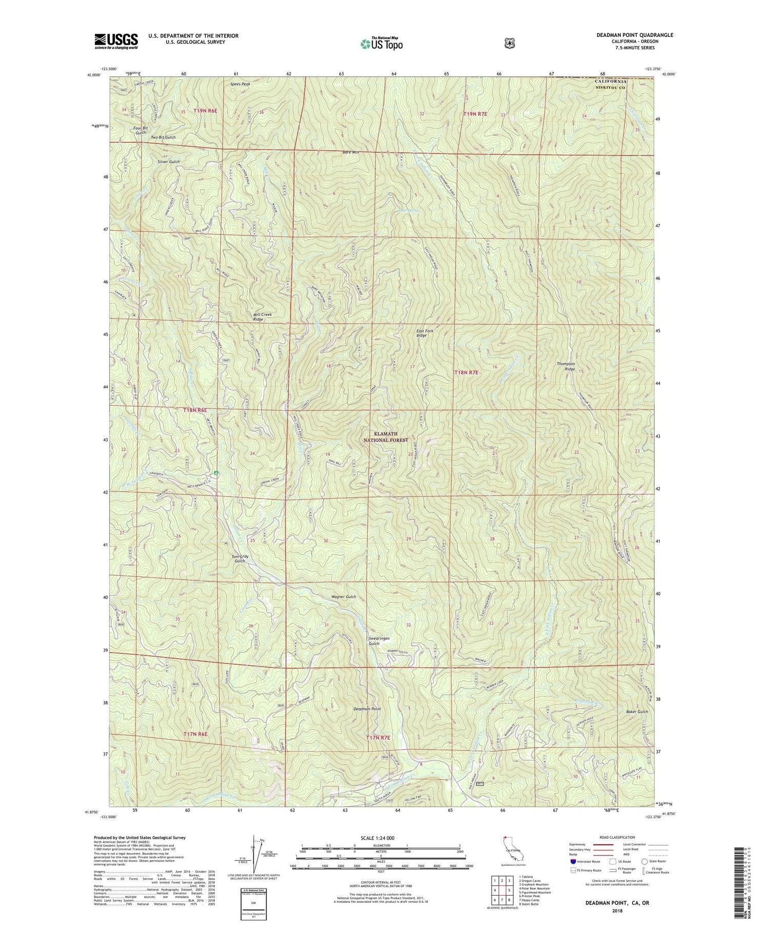
Deadman Point California US Topo Map
Couldn't load pickup availability
Also explore the Deadman Point Forest Service Topo of this same quad for updated USFS data
2022 topographic map quadrangle Deadman Point in the state of California. Scale: 1:24000. Based on the newly updated USGS 7.5' US Topo map series, this map is in the following counties: Siskiyou, Josephine. The map contains contour data, water features, and other items you are used to seeing on USGS maps, but also has updated roads and other features. This is the next generation of topographic maps. Printed on high-quality waterproof paper with UV fade-resistant inks.
Quads adjacent to this one:
West: Polar Bear Mountain
Northwest: Takilma
North: Oregon Caves
Northeast: Grayback Mountain
East: Figurehead Mountain
Southeast: Slater Butte
South: Happy Camp
Southwest: Preston Peak
Contains the following named places: Bald Hornet Creek, Bare Mountain, Blue Bar Mine, Cedar Spring, Classic Hill Mine, Clauson Creek, Coon Run, County Mine, Deadman Point, Des Moines Creek, East Fork Indian Creek, East Fork Ridge, Four Bit Gulch, Granite Creek, Green Creek, Huey Mine, Jade Mine, King Bill Ranch, Mill Creek, Mill Creek Ridge, Munson Mine, Rhodonite Creek, Rhodonite Mine, Silver Gulch, Snowbrush Mine, South Fork Indian Creek, Spees Peak, Spees Peak Trail, Sutcliffe Creek, Swearingen Gulch, Tanner Gulch, Tennessee Gulch, Tom Gray Gulch, Two Bit Gulch, Wagner Gulch, West Branch Campground, West Branch Guard Station, West Branch Indian Creek, Wood Mine