MyTopo
Gunter Oregon US Topo Map
Couldn't load pickup availability
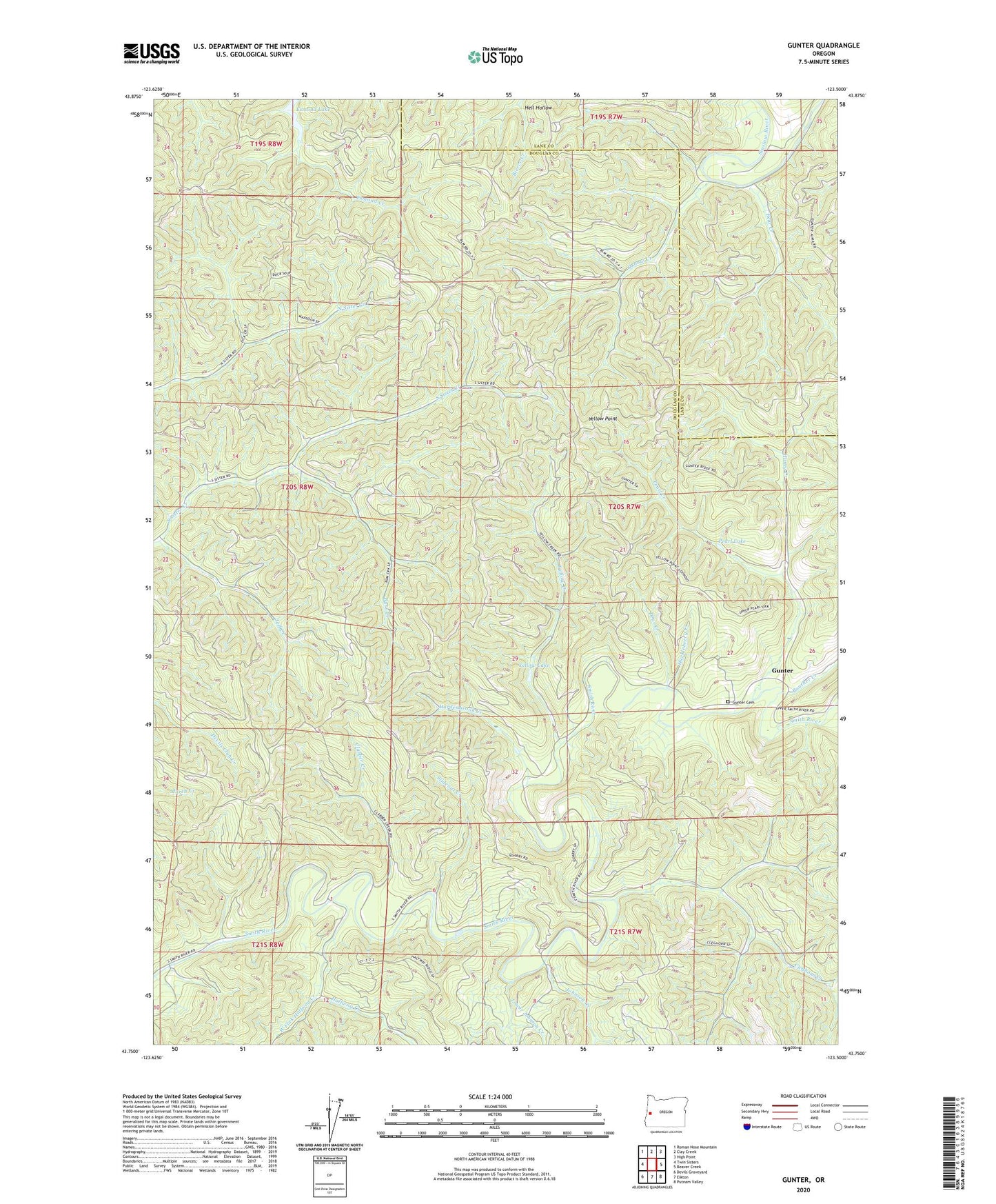
2023 topographic map quadrangle Gunter in the state of Oregon. Scale: 1:24000. Based on the newly updated USGS 7.5' US Topo map series, this map is in the following counties: Douglas, Lane. The map contains contour data, water features, and other items you are used to seeing on USGS maps, but also has updated roads and other features. This is the next generation of topographic maps. Printed on high-quality waterproof paper with UV fade-resistant inks.
Quads adjacent to this one:
West: Twin Sisters
Northwest: Roman Nose Mountain
North: Clay Creek
Northeast: High Point
East: Beaver Creek
Southeast: Putnam Valley
South: Elkton
Southwest: Devils Graveyard
This map covers the same area as the classic USGS quad with code o43123g5.
Contains the following named places: Amberson Creek, Bear Creek, Burn Creek, Clabber Creek, Cleghorn Creek, Dear Creek, Esmond Lake, Eula Post Office, Gunter, Gunter Cemetery, Gunter Post Office, Haight Creek, Halfway Creek, Haney Creek, Hardenbrook Creek, Hell Hollow, Huckleberry Creek, Jeff Creek, Johnson Creek, Lower Johnson Creek, Oxbow Creek, Panther Creek, Panther Creek School, Pearl Creek, Pearl Lake, Slideout Creek, West Fork Halfway Creek, Yellow Creek, Yellow Lake, Yellow Lookout, Yellow Point