MyTopo
Beaver Creek Oregon US Topo Map
Couldn't load pickup availability
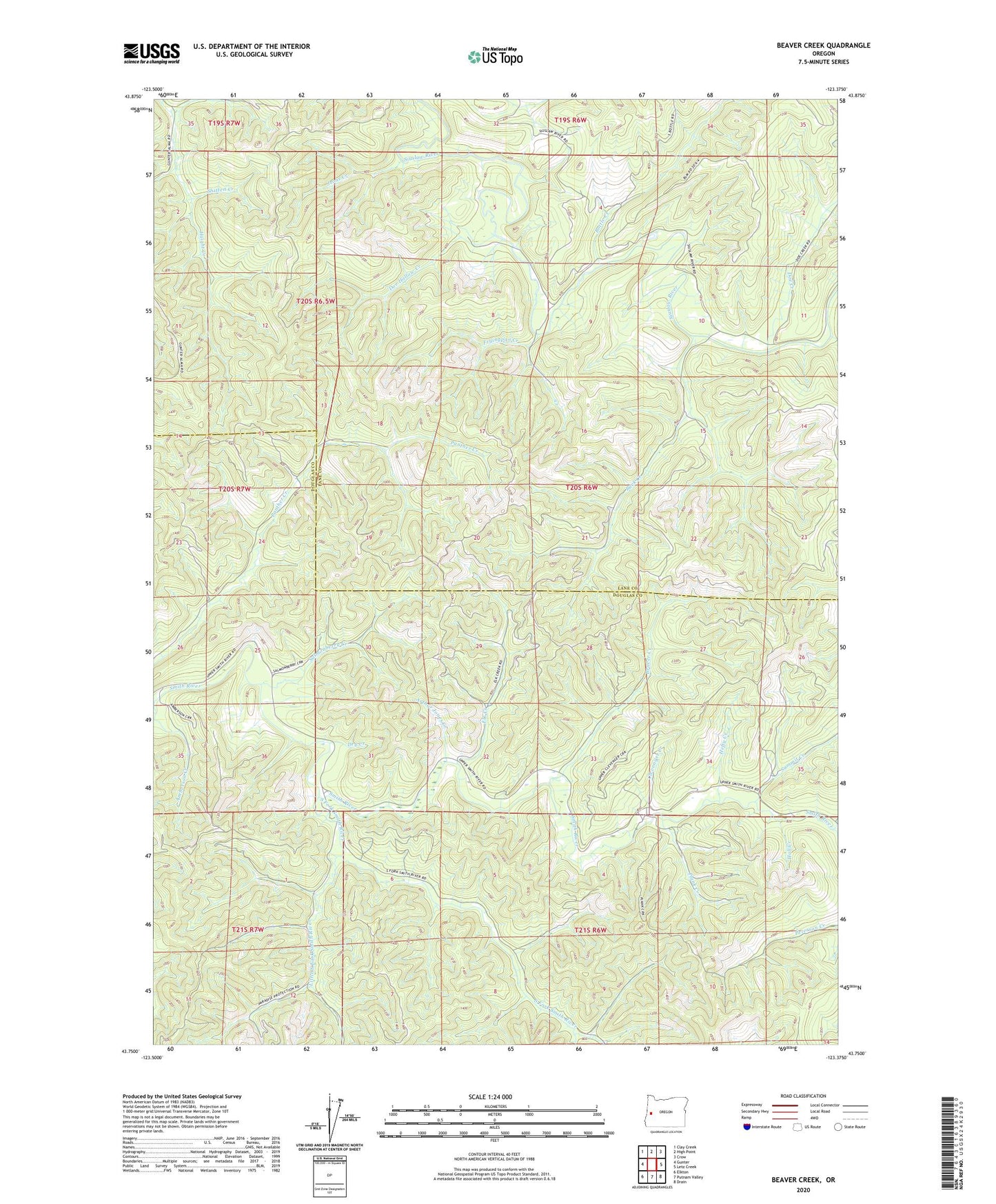
2023 topographic map quadrangle Beaver Creek in the state of Oregon. Scale: 1:24000. Based on the newly updated USGS 7.5' US Topo map series, this map is in the following counties: Lane, Douglas. The map contains contour data, water features, and other items you are used to seeing on USGS maps, but also has updated roads and other features. This is the next generation of topographic maps. Printed on high-quality waterproof paper with UV fade-resistant inks.
Quads adjacent to this one:
West: Gunter
Northwest: Clay Creek
North: High Point
Northeast: Crow
East: Letz Creek
Southeast: Drain
South: Putnam Valley
Southwest: Elkton
This map covers the same area as the classic USGS quad with code o43123g4.
Contains the following named places: Arthur Jones Creek, Beaver Creek, Beaver Creek School, Bottle Creek, Buck Creek, Clevenger Creek, Doe Creek, Doe Hollow Creek, Dry Creek, Elk Creek, Elkton-Drain Division, Fryingpan Creek, Hall Creek, Hefty Creek, Jeans Creek, Little South Fork Smith River, Plank Creek, Redford Creek, Salmonberry Creek, Shitten Creek, South Fork Guard Station, South Fork Smith River, Summit Creek, Woolley Post Office