MyTopo
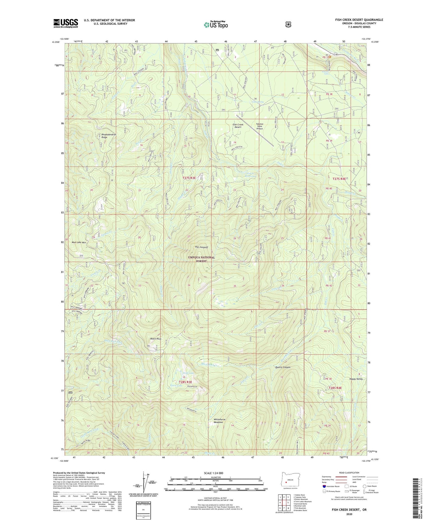
Fish Creek Desert Oregon US Topo Map
Couldn't load pickup availability
Also explore the Fish Creek Desert Forest Service Topo of this same quad for updated USFS data
2024 topographic map quadrangle Fish Creek Desert in the state of Oregon. Scale: 1:24000. Based on the newly updated USGS 7.5' US Topo map series, this map is in the following counties: Douglas. The map contains contour data, water features, and other items you are used to seeing on USGS maps, but also has updated roads and other features. This is the next generation of topographic maps. Printed on high-quality waterproof paper with UV fade-resistant inks.
Quads adjacent to this one:
West: Twin Lakes Mountain
Northwest: Illahee Rock
North: Toketee Falls
Northeast: Potter Mountain
East: Garwood Butte
Southeast: Hamaker Butte
South: Fish Mountain
Southwest: Buckeye Lake
This map covers the same area as the classic USGS quad with code o43122b4.
Contains the following named places: Beaver Shelter, Big Camp Ranger Station, Black Rock, Black Rock Creek, Black Rock Trail, Brodie Creek, Camas Creek, Camas Creek Campground, Cedar Spring, Clear Creek, Eva Creek, Fawn Creek, Fawn Lake, Fish Creek Campground, Fish Creek Canal, Fish Creek Desert, Fish Creek Diversion Dam, Fish Creek Reservoir, Grave Creek, Grave Creek Trail, Greek Creek, Happy Valley, Mud Lake Mountain, No Tunnel Creek, Pine Creek, Quartz Canyon, Rattlesnake Way, Rhododendron Ridge, Rolling Grounds, Rolling Grounds Camp, Rough Creek, Slipper Creek, The Jumpoff, Toketee State Airport, Watson Falls, Watson Falls Recreation Site, Whitehorse Meadows, Wolf Lake