MyTopo
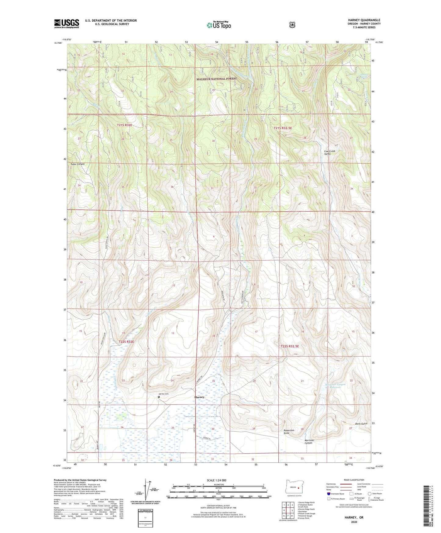
Harney Oregon US Topo Map
Couldn't load pickup availability
Also explore the Harney Forest Service Topo of this same quad for updated USFS data
2023 topographic map quadrangle Harney in the state of Oregon. Scale: 1:24000. Based on the newly updated USGS 7.5' US Topo map series, this map is in the following counties: Harney. The map contains contour data, water features, and other items you are used to seeing on USGS maps, but also has updated roads and other features. This is the next generation of topographic maps. Printed on high-quality waterproof paper with UV fade-resistant inks.
Quads adjacent to this one:
West: Devine Ridge South
Northwest: Devine Ridge North
North: Telephone Butte
Northeast: Craft Point
East: Buchanan
Southeast: Carson Point
South: Ninemile Slough
Southwest: Poison Creek Slough
This map covers the same area as the classic USGS quad with code o43118f7.
Contains the following named places: Coffeepot Creek, Davis Gulch, Davis Well, East Fork Rattlesnake Creek, Fort Harney, Harney, Harney Cemetery, Harney Post Office, Mill Creek, Mortimer Canyon, Mortimer Canyon Dam, Mortimer Canyon Reservoir, Rattlesnake Creek, Robertson Draw, Shellrock Spring, West Fork Rattlesnake Creek