MyTopo
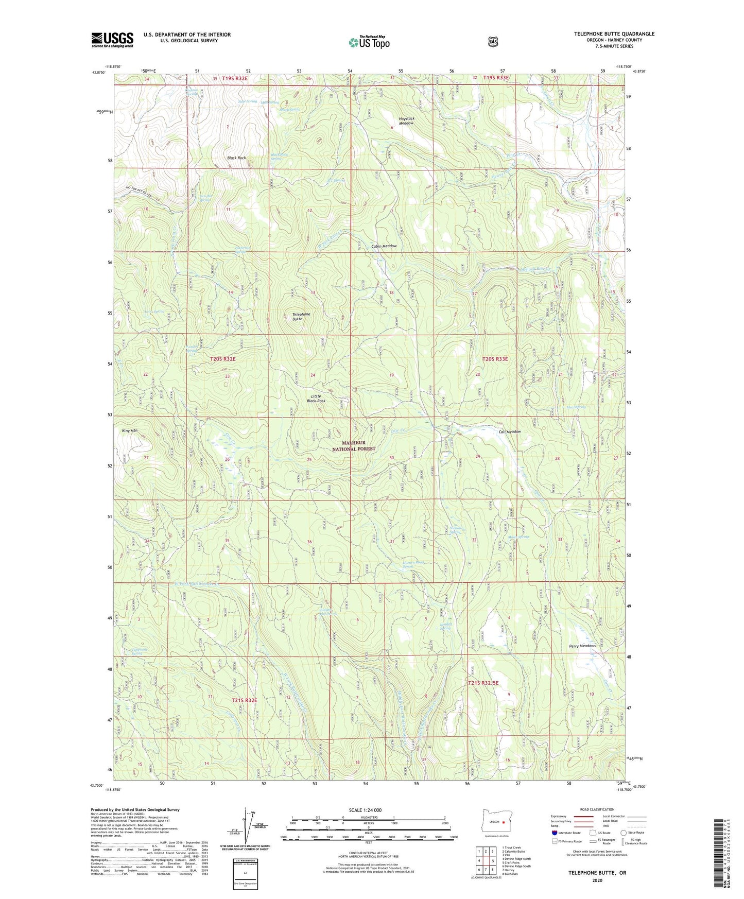
Telephone Butte Oregon US Topo Map
Couldn't load pickup availability
Also explore the Telephone Butte Forest Service Topo of this same quad for updated USFS data
2023 topographic map quadrangle Telephone Butte in the state of Oregon. Scale: 1:24000. Based on the newly updated USGS 7.5' US Topo map series, this map is in the following counties: Harney. The map contains contour data, water features, and other items you are used to seeing on USGS maps, but also has updated roads and other features. This is the next generation of topographic maps. Printed on high-quality waterproof paper with UV fade-resistant inks.
Quads adjacent to this one:
West: Devine Ridge North
Northwest: Trout Creek
North: Calamity Butte
Northeast: Van
East: Craft Point
Southeast: Buchanan
South: Harney
Southwest: Devine Ridge South
This map covers the same area as the classic USGS quad with code o43118g7.
Contains the following named places: Alkali Creek, Beaverdam Creek, Black Rock, Black Rock Spring, Cabin Meadow, Call Meadow, Call Meadow Forest Service Facility, Call Meadow Trail, Cochran Spring, Harney Road Spring, Haystack Meadow, Ideal Spring, Juniper Flat Spring, Kendall Spring, King Mountain, King Mountain Lookout, Lems Spring, Little Black Rock, Lowe Mill, Middle Fork Rattlesnake Creek, Miller Spring, Mud Spring, Nichols Spring, Old McKinney Mill, P and P Spring, Patterson Spring, Perry Meadows, R T Spring, Rattlesnake Trail, Sage Spring, Sheep Spring, Telephone Butte, Telephone Spring, Two-Bit Spring, West Fork Pine Creek