MyTopo
Harvey Mountain Oregon US Topo Map
Couldn't load pickup availability
Also explore the Harvey Mountain Forest Service Topo of this same quad for updated USFS data
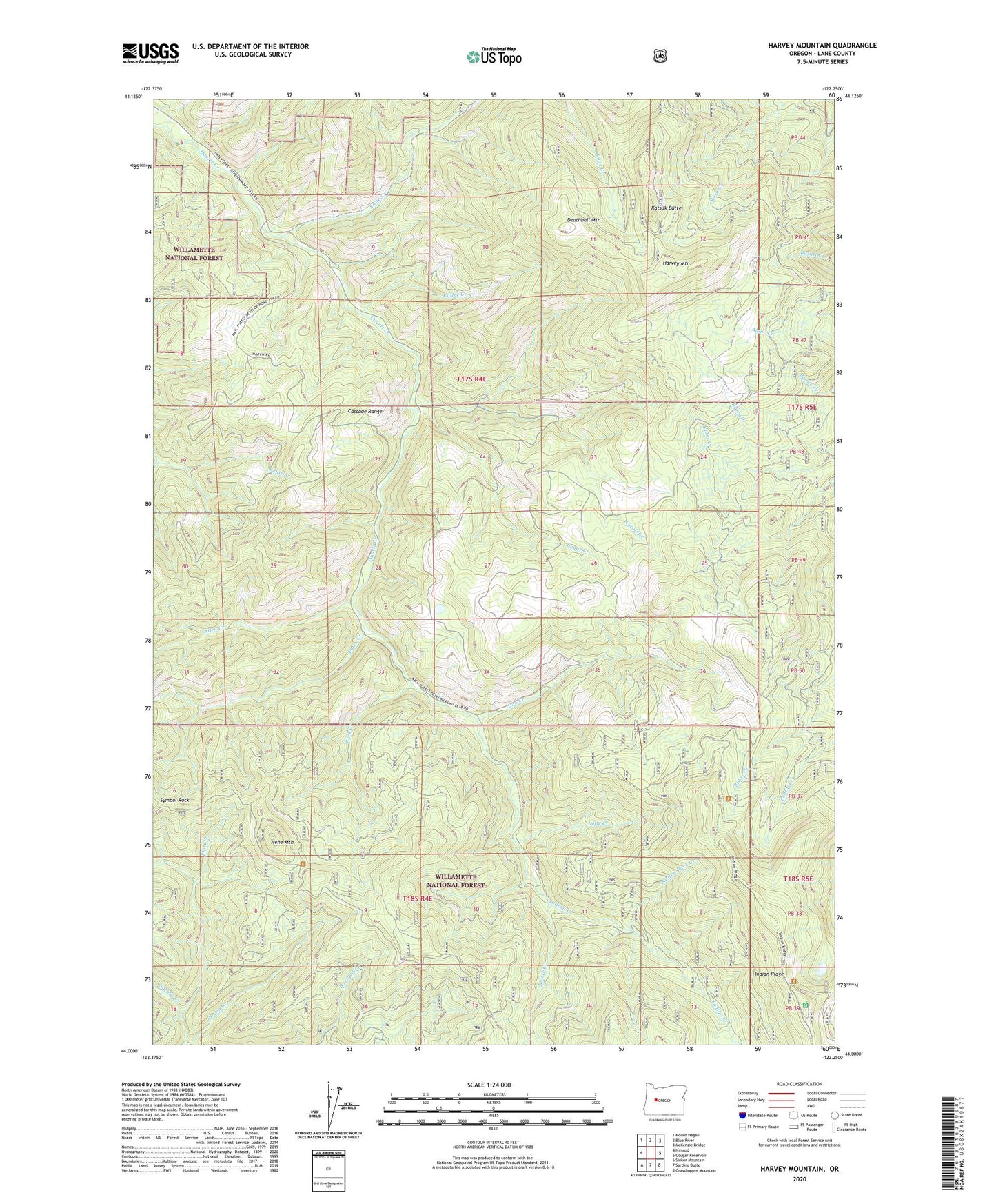
2023 topographic map quadrangle Harvey Mountain in the state of Oregon. Scale: 1:24000. Based on the newly updated USGS 7.5' US Topo map series, this map is in the following counties: Lane. The map contains contour data, water features, and other items you are used to seeing on USGS maps, but also has updated roads and other features. This is the next generation of topographic maps. Printed on high-quality waterproof paper with UV fade-resistant inks.
Quads adjacent to this one:
West: Nimrod
Northwest: Mount Hagan
North: Blue River
Northeast: McKenzie Bridge
East: Cougar Reservoir
Southeast: Grasshopper Mountain
South: Sardine Butte
Southwest: Sinker Mountain
This map covers the same area as the classic USGS quad with code o44122a3.
Contains the following named places: Allen Creek, Briem Creek, Buck Creek, Cane Creek, Coffee Creek, Deathball Mountain, Doe Creek, Fall Creek Trail, Fawn Creek, Harvey Mountain, Hehe Mountain, Indian Creek, Indian Ridge, Katsuk Butte, Lytle Creek, Pernot Trail, Rosey Creek, Saturn Creek, Sugar Creek, Switch Back Creek, Symbol Rock, Wycoff Creek