MyTopo
Blue River Oregon US Topo Map
Couldn't load pickup availability
Also explore the Blue River Forest Service Topo of this same quad for updated USFS data
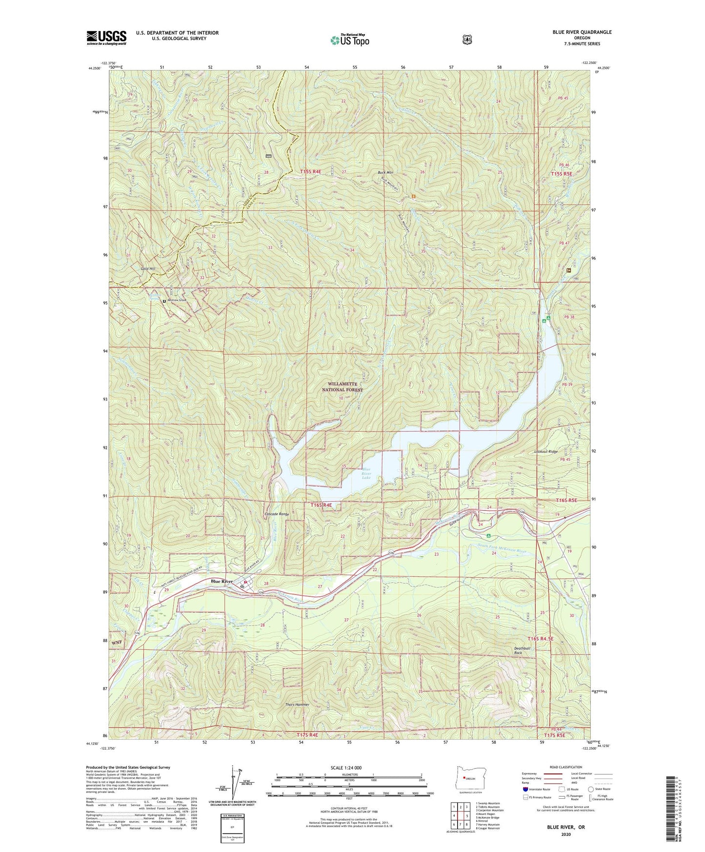
2024 topographic map quadrangle Blue River in the state of Oregon. Scale: 1:24000. Based on the newly updated USGS 7.5' US Topo map series, this map is in the following counties: Lane, Linn. The map contains contour data, water features, and other items you are used to seeing on USGS maps, but also has updated roads and other features. This is the next generation of topographic maps. Printed on high-quality waterproof paper with UV fade-resistant inks.
Quads adjacent to this one:
West: Mount Hagan
Northwest: Swamp Mountain
North: Tidbits Mountain
Northeast: Carpenter Mountain
East: McKenzie Bridge
Southeast: Cougar Reservoir
South: Harvey Mountain
Southwest: Nimrod
This map covers the same area as the classic USGS quad with code o44122b3.
Contains the following named places: Blue River, Blue River Community Park, Blue River Dam, Blue River Lake, Blue River Post Office, Blue River Ranger Station, Blue River Volunteer Fire Department, Bruckert Bridge Boat Ramp, Buck Mountain, Cinderella Mine, Clapper Creek, Cone Creek, Deathball Rock, Delta Recreation Site, Doris Creek, East Fork Keeney Creek, Eighteen Creek, Elk Creek, Fern Creek, Forest Glen Landing Boat Ramp, Forest Glen Landing County Park, Gold Hill, H J Andrews Experimental Forest Headquarters, H J Andrews Monument, Hamlin Boat Landing, Hamlin Landing Boat Ramp, Keeney Creek, Lookout Campground Boat Ramp, Lookout Creek, Lookout Recreation Site, Lucky Boy Mine, Luckyboy Post Office, McKenzie Elementary School, McKenzie River Elementary School, McKenzie River Park, Mona Campground Boat Ramp, Mona Creek, Mona Recreation Site, North Fork Quartz Creek, North Star Mine, Ore Creek, Quartz Creek, Renfrew Grave, Renfrew Spring, Rialto Mine, Saddle Dam, Saddle Dam Boat Launch Boat Ramp, Saddle Dam Boat Ramp, Scout Creek, Simmonds Creek, South Fork McKenzie River, Sparks Creek, Strube Dam, Strube Lake, Strubes Forest Camp, Thors Hammer, Tidbits Creek, Treadwell Creek, West Fork Keeney Creek