MyTopo
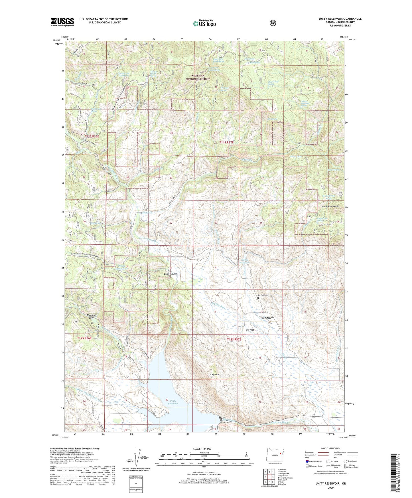
Unity Reservoir Oregon US Topo Map
Couldn't load pickup availability
Also explore the Unity Reservoir Forest Service Topo of this same quad for updated USFS data
2024 topographic map quadrangle Unity Reservoir in the state of Oregon. Scale: 1:24000. Based on the newly updated USGS 7.5' US Topo map series, this map is in the following counties: Baker. The map contains contour data, water features, and other items you are used to seeing on USGS maps, but also has updated roads and other features. This is the next generation of topographic maps. Printed on high-quality waterproof paper with UV fade-resistant inks.
Quads adjacent to this one:
West: Pogue Point
Northwest: Whitney
North: Sumpter
Northeast: Phillips Lake
East: Beaverdam Creek
Southeast: Hereford
South: Unity
Southwest: Rail Gulch
This map covers the same area as the classic USGS quad with code o44118e2.
Contains the following named places: Antelope Creek, Audrey, Audrey Post Office, Badger Hole Spring, Barrel Spring, Big Flat, Big Flat Cemetery, Big Flat Ditch, China Creek, China Creek Ditch, China Creek Spring, China Lake, Cottonwood Buttes, Cottonwood Creek, Curran Mountain Spring, Day Spring, Derringer Spring, Dooley Gulch, Dooley Gulch Pond, First Creek, Fourth Creek Trail Spring, Hanby Reservoir, Head Meadow, Hereford Division, King Mountain, King Ranch, King Spring, Lick Creek, Lower First Creek Spring, Martins Mill, Max Spring, Middle Fork Burnt River, Mud Spring, Mud Spring Pond, North Fork Burnt River, Pine Creek, Second Creek, Second Creek Spring, Sheep Creek, Third Creek, Third Creek Spring, Thompson Ditch, Thompson Gulch, Unity Dam, Unity Lake State Recreation Site Boat Ramp, Unity Reservoir, Upper First Creek Spring, West Fork Burnt River