MyTopo
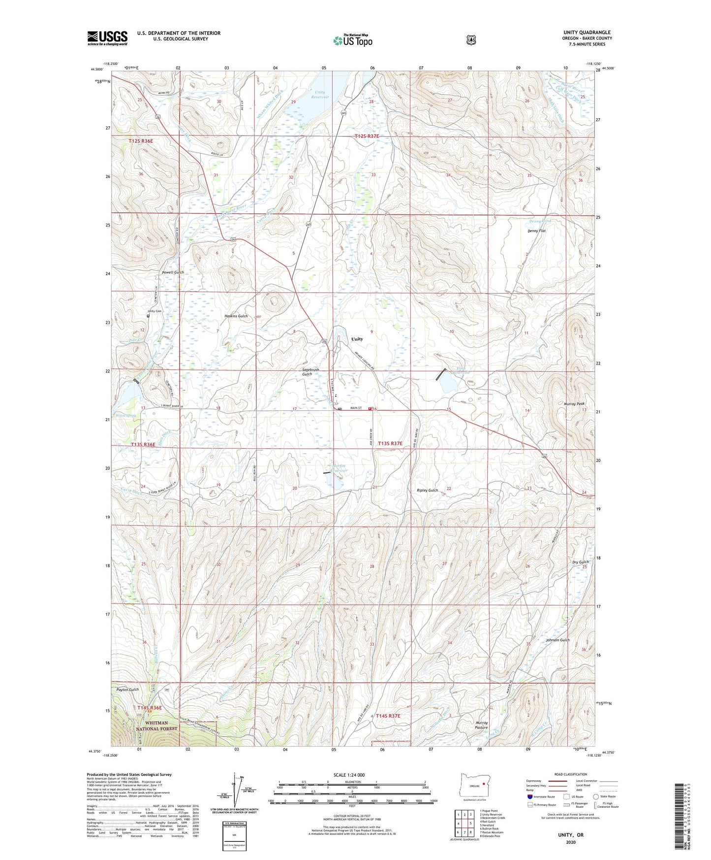
Unity Oregon US Topo Map
Couldn't load pickup availability
Also explore the Unity Forest Service Topo of this same quad for updated USFS data
2023 topographic map quadrangle Unity in the state of Oregon. Scale: 1:24000. Based on the newly updated USGS 7.5' US Topo map series, this map is in the following counties: Baker. The map contains contour data, water features, and other items you are used to seeing on USGS maps, but also has updated roads and other features. This is the next generation of topographic maps. Printed on high-quality waterproof paper with UV fade-resistant inks.
Quads adjacent to this one:
West: Rail Gulch
Northwest: Pogue Point
North: Unity Reservoir
Northeast: Beaverdam Creek
East: Hereford
Southeast: Eldorado Pass
South: Rastus Mountain
Southwest: Bullrun Rock
This map covers the same area as the classic USGS quad with code o44118d2.
Contains the following named places: Burnt River School, City of Unity, Colt Ware Ditch, Curop Ditch, Denny Flat, Denny Pond, Dry Gulch, Ellingson Lumber Company Airstrip, Elms Dam, Elms Ditch, Elms Reservoir, Haskins Gulch, High Line Ditch, Job Creek, Johnson Gulch, Long Creek, Morfitt Dam, Morfitt Reservoir, Murray Pasture, Payton Gulch, Pole Creek, Powell Gulch, Powell Ranch, Record Mine, Ripley Gulch, Sagebrush Gulch, Shirts Creek, South Fork Burnt River, Tiger Ditch, Unity, Unity Cemetery, Unity Community Hall, Unity Lake State Recreation Site, Unity Post Office, Unity Ranger Station, Unity Volunteer Fire Department, Unity Wastewater Treatment Lagoon, Warm Spring, Wham Whited Ditch, Whited Dam, Whited Reservoir, Williams Ditch, ZIP Code: 97884