MyTopo
Greenleaf Oregon US Topo Map
Couldn't load pickup availability
Also explore the Greenleaf Forest Service Topo of this same quad for updated USFS data
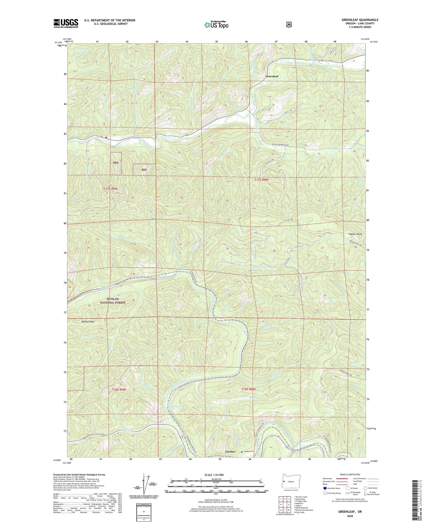
2024 topographic map quadrangle Greenleaf in the state of Oregon. Scale: 1:24000. Based on the newly updated USGS 7.5' US Topo map series, this map is in the following counties: Lane. The map contains contour data, water features, and other items you are used to seeing on USGS maps, but also has updated roads and other features. This is the next generation of topographic maps. Printed on high-quality waterproof paper with UV fade-resistant inks.
Quads adjacent to this one:
West: Mapleton
Northwest: Herman Creek
North: Windy Peak
Northeast: Triangle Lake
East: Walton
Southeast: Clay Creek
South: Roman Nose Mountain
Southwest: Baldy Mountain
This map covers the same area as the classic USGS quad with code o44123a6.
Contains the following named places: A G Spence, Almasie Creek, Austa, Austa Boat Ramp, Austa Landing County Park, Barber Creek, Beecher, Beecher Creek, Camp Lane, Camp Lane County Park, Cosmos, Dry Creek, Glentena Post Office, Greenleaf, Greenleaf Creek Pole Slide, Greenleaf Post Office, H L Bergman, Hollo Creek, Johnston Creek, Kirbros, Leaver Creek, Linslaw, Linslaw Cemetery, Linslaw County Park, Linslaw Post Office, Little Beech Creek, McVey Creek, Meadow Creek, Meadow Post Office, Middle Siuslaw River-Triangle Lake Division, Nelson Creek, Nelson Guard Station, Pat Creek, Preston Creek, Richardson, Richardson Pole Slide, Rock Creek, Rollo, San Antone Creek, Schoolhouse Creek, Sharon Creek, Siuslaw School, Smith Creek, Steinhauer Creek, Swisshome - Deadwood Rural Fire Protection District Station 2, Turner Creek, Turner Creek Camp, Waite Creek, Walker Point, Wheeler Creek, Wilcut Creek, Wildcat Creek