MyTopo
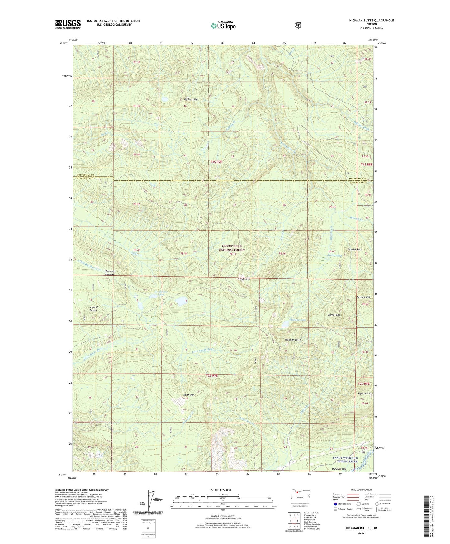
Hickman Butte Oregon US Topo Map
Couldn't load pickup availability
Also explore the Hickman Butte Forest Service Topo of this same quad for updated USFS data
2024 topographic map quadrangle Hickman Butte in the state of Oregon. Scale: 1:24000. Based on the newly updated USGS 7.5' US Topo map series, this map is in the following counties: Clackamas, Multnomah. The map contains contour data, water features, and other items you are used to seeing on USGS maps, but also has updated roads and other features. This is the next generation of topographic maps. Printed on high-quality waterproof paper with UV fade-resistant inks.
Quads adjacent to this one:
West: Brightwood
Northwest: Multnomah Falls
North: Tanner Butte
Northeast: Wahtum Lake
East: Bull Run Lake
Southeast: Government Camp
South: Rhododendron
Southwest: Wildcat Mountain
This map covers the same area as the classic USGS quad with code o45121d8.
Contains the following named places: Aschoff Buttes, Bedrock Creek, Big Bend Mountain, Big Bend Trail, Blazed Alder Creek, Bull Run Water Shed, Bull Run Watershed, Burnt Peak, Clear Creek Way Trail, County Creek, Deer Meadows, Goodfellow Lakes, Goodfellow Quarry, Halfway Hill, Hickman Butte, Hickman Creek, Hickman Lake, Larson Way Trail, Little Clear Creek, Meadow Quarry, Nanny Creek, North Mountain, Sugarloaf Mountain, Thimble Mountain, Thimble Mountain Trail, Thunder Rock, Township Meadow