MyTopo
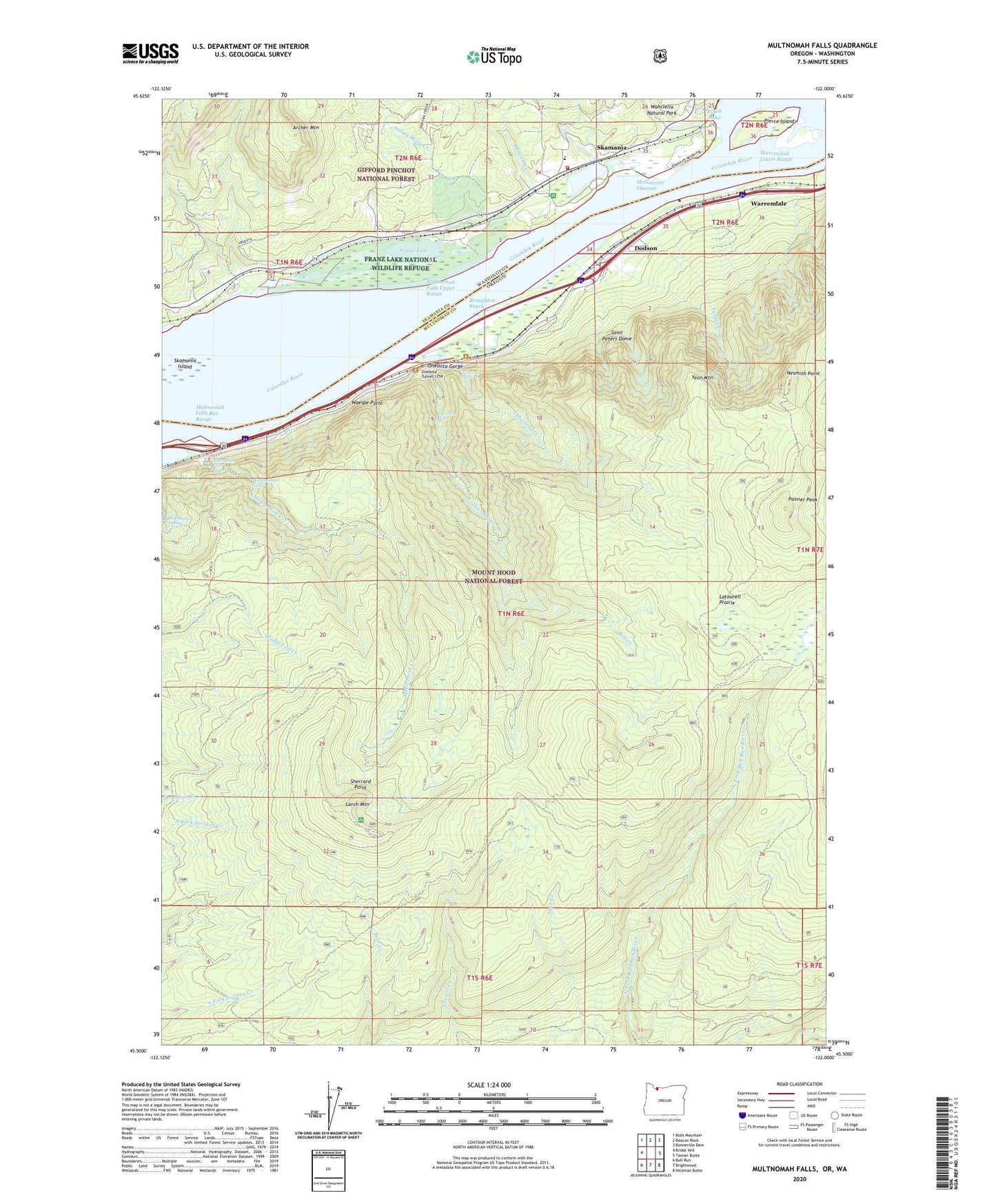
Multnomah Falls Oregon US Topo Map
Couldn't load pickup availability
Also explore the Multnomah Falls Forest Service Topo of this same quad for updated USFS data
2024 topographic map quadrangle Multnomah Falls in the states of Oregon, Washington. Scale: 1:24000. Based on the newly updated USGS 7.5' US Topo map series, this map is in the following counties: Multnomah, Skamania. The map contains contour data, water features, and other items you are used to seeing on USGS maps, but also has updated roads and other features. This is the next generation of topographic maps. Printed on high-quality waterproof paper with UV fade-resistant inks.
Quads adjacent to this one:
West: Bridal Veil
Northwest: Bobs Mountain
North: Beacon Rock
Northeast: Bonneville Dam
East: Tanner Butte
Southeast: Hickman Butte
South: Brightwood
Southwest: Bull Run
Contains the following named places: Ainsworth State Park, Archer Mountain, Bell Creek, Benson State Park, Butler Creek, Corbett Division, Cougar Trail, Dodson, Duncan Creek, Franz Lake, Franz Lake National Wildlife Refuge, Horsetail Creek, Horsetail Falls, Horsetail Falls Recreation Site, Indian Mary Creek, Larch Mountain, Larch Mountain Recreation Site, Latourell Prairie, Little Creek, McCord Creek, McGowans Channel, McLaughlin State Park, Multnomah Creek, Multnomah Falls, Multnomah Falls Bar, Multnomah Falls Bar Range, Multnomah Falls Recreation Site, Multnomah Falls Upper Range, Nesmith Point, North Fork Dam, North Fork Gordon Creek, Oneonta, Oneonta Creek, Oneonta Falls, Oneonta Gorge, Oneonta Gorge Botanical Area, Oneonta Post Office, Oneonta Tunnel 1759, Palmer Peak, Pierce Island, Ridell Lake, Saint Cloud, Saint Peters Dome, Sherrard Point, Skamania, Skamania County Fire District 5 Skamania, Skamania Island, Skamania Landing, Skamania School, The Fishery Boat Ramp, Tumalt Creek, Waespe Point, Wahclella Natural Park, Wahkeena Spring, Warrendale, Warrendale Lower Range, Warrendale Post Office, Wiesendanger Falls, Woodard Creek, Woodard Dam, Yeon Mountain, ZIP Code: 97014