
MyTopo
Horse Heaven Creek Oregon US Topo Map
Couldn't load pickup availability
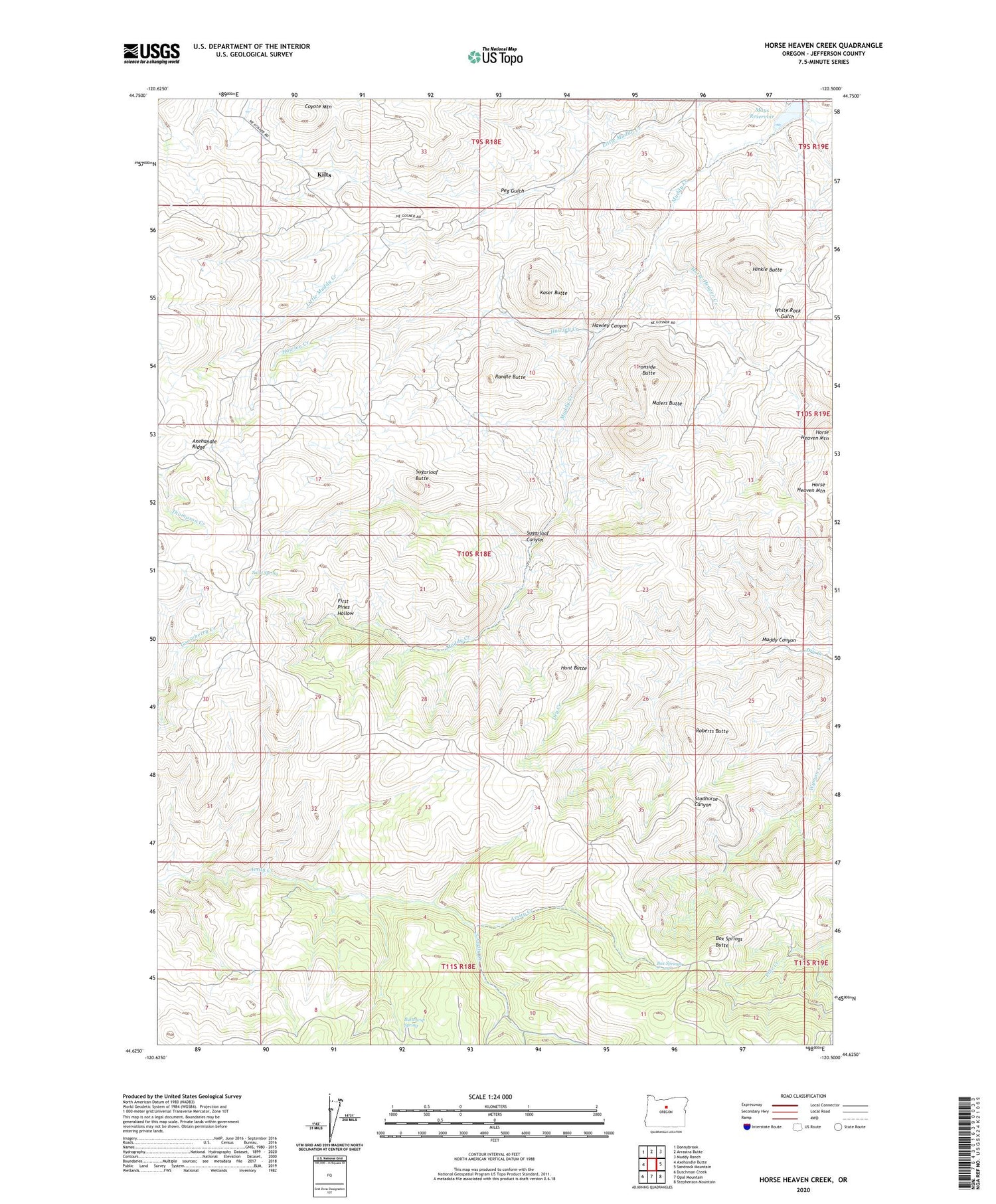
2020 topographic map quadrangle Horse Heaven Creek in the state of Oregon. Scale: 1:24000. Based on the newly updated USGS 7.5' US Topo map series, this map is in the following counties: Jefferson. The map contains contour data, water features, and other items you are used to seeing on USGS maps, but also has updated roads and other features. This is the next generation of topographic maps. Printed on high-quality waterproof paper with UV fade-resistant inks.
Quads adjacent to this one:
West: Axehandle Butte
Northwest: Donnybrook
North: Arrastra Butte
Northeast: Muddy Ranch
East: Sandrock Mountain
Southeast: Stephenson Mountain
South: Opal Mountain
Southwest: Dutchman Creek
Contains the following named places: Box Springs, Box Springs Butte, Buttercup Spring, Coyote Mountain, First Pines Hollow, Hawley Canyon, Hawley Creek, Hinkle Butte, Horse Heaven Creek, Horse Heaven Mine, Horse Heaven Post Office, Horseheaven, Hunt Butte, Ironside Butte, Kaser Butte, Kilts, Kilts Post Office, Maiers Butte, Mays Reservoir, Muddy Canyon, Peg Gulch, Randle Butte, Roberts Butte, Sand Spring, South Amity Creek, Sugarloaf Butte, Sugarloaf Canyon


