MyTopo
Hurley Flat Oregon US Topo Map
Couldn't load pickup availability
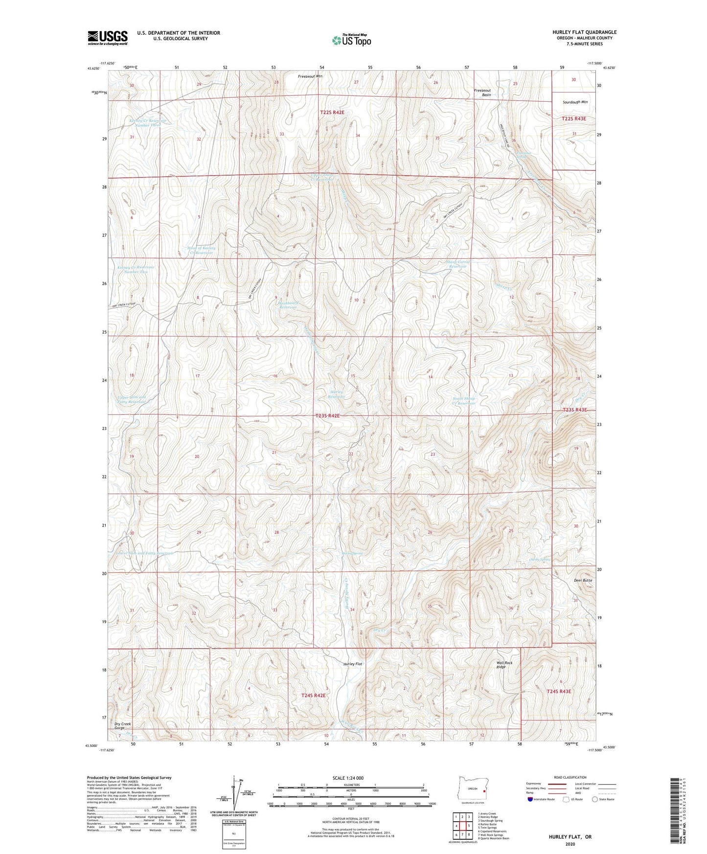
2024 topographic map quadrangle Hurley Flat in the state of Oregon. Scale: 1:24000. Based on the newly updated USGS 7.5' US Topo map series, this map is in the following counties: Malheur. The map contains contour data, water features, and other items you are used to seeing on USGS maps, but also has updated roads and other features. This is the next generation of topographic maps. Printed on high-quality waterproof paper with UV fade-resistant inks.
Quads adjacent to this one:
West: Rufino Butte
Northwest: Avery Creek
North: Keeney Ridge
Northeast: Sourdough Spring
East: Twin Springs
Southeast: Quartz Mountain Basin
South: Wall Rock Springs
Southwest: Copeland Reservoirs
This map covers the same area as the classic USGS quad with code o43117e5.
Contains the following named places: Cherry Spring, Deer Butte, Dry Creek Gorge, Freezeout Mountain, Freezeout Spring, Head of Keeney Creek Reservoir, Hurley Flat, Hurley Reservoir, Hurley Spring, Hurley Spring Creek, Keeney Creek Reservoir Number Three, Keeney Creek Reservoir Number Two, Lower Slim and Fatty Reservoir, Sheep Corral Reservoir, Sheep Creek, South Sheep Creek Reservoir, Upper Sheep Creek Reservoir, Upper Slim and Fatty Reservoir, Wall Rock Creek, Washboard Reservoir