MyTopo
Twin Springs Oregon US Topo Map
Couldn't load pickup availability
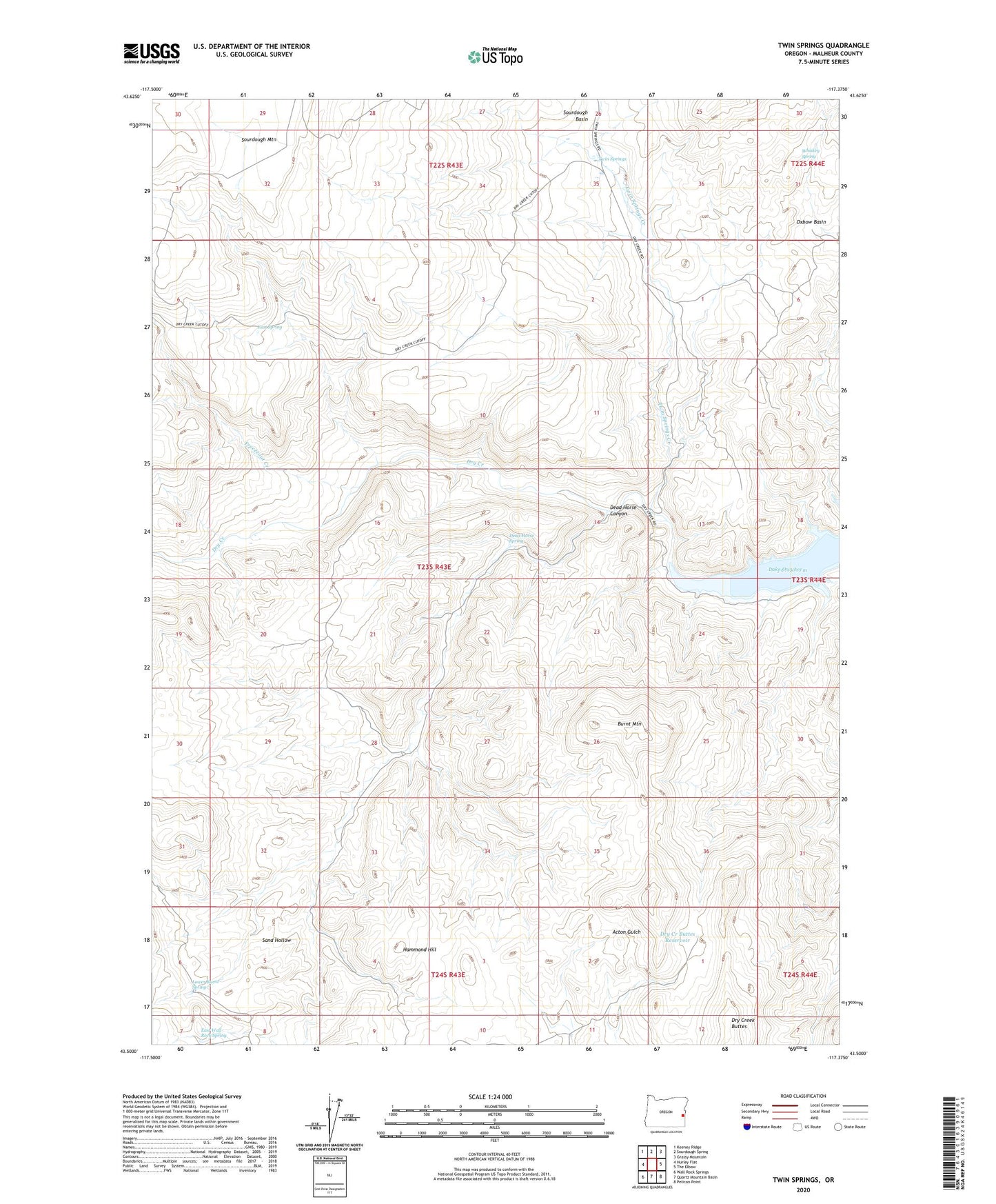
2024 topographic map quadrangle Twin Springs in the state of Oregon. Scale: 1:24000. Based on the newly updated USGS 7.5' US Topo map series, this map is in the following counties: Malheur. The map contains contour data, water features, and other items you are used to seeing on USGS maps, but also has updated roads and other features. This is the next generation of topographic maps. Printed on high-quality waterproof paper with UV fade-resistant inks.
Quads adjacent to this one:
West: Hurley Flat
Northwest: Keeney Ridge
North: Sourdough Spring
Northeast: Grassy Mountain
East: The Elbow
Southeast: Pelican Point
South: Quartz Mountain Basin
Southwest: Wall Rock Springs
This map covers the same area as the classic USGS quad with code o43117e4.
Contains the following named places: Burnt Mountain, Dead Horse Canyon, Dead Horse Spring, Dry Creek Buttes, Dry Creek Buttes Reservoir, Dry Creek Camp, East Spring, East Wall Rock Spring, Freezeout Creek, Hammond Hill, Lower Burnt Spring, Sand Hollow, Twin Springs, Twin Springs Creek, Whiskey Spring