MyTopo
Rufino Butte Oregon US Topo Map
Couldn't load pickup availability
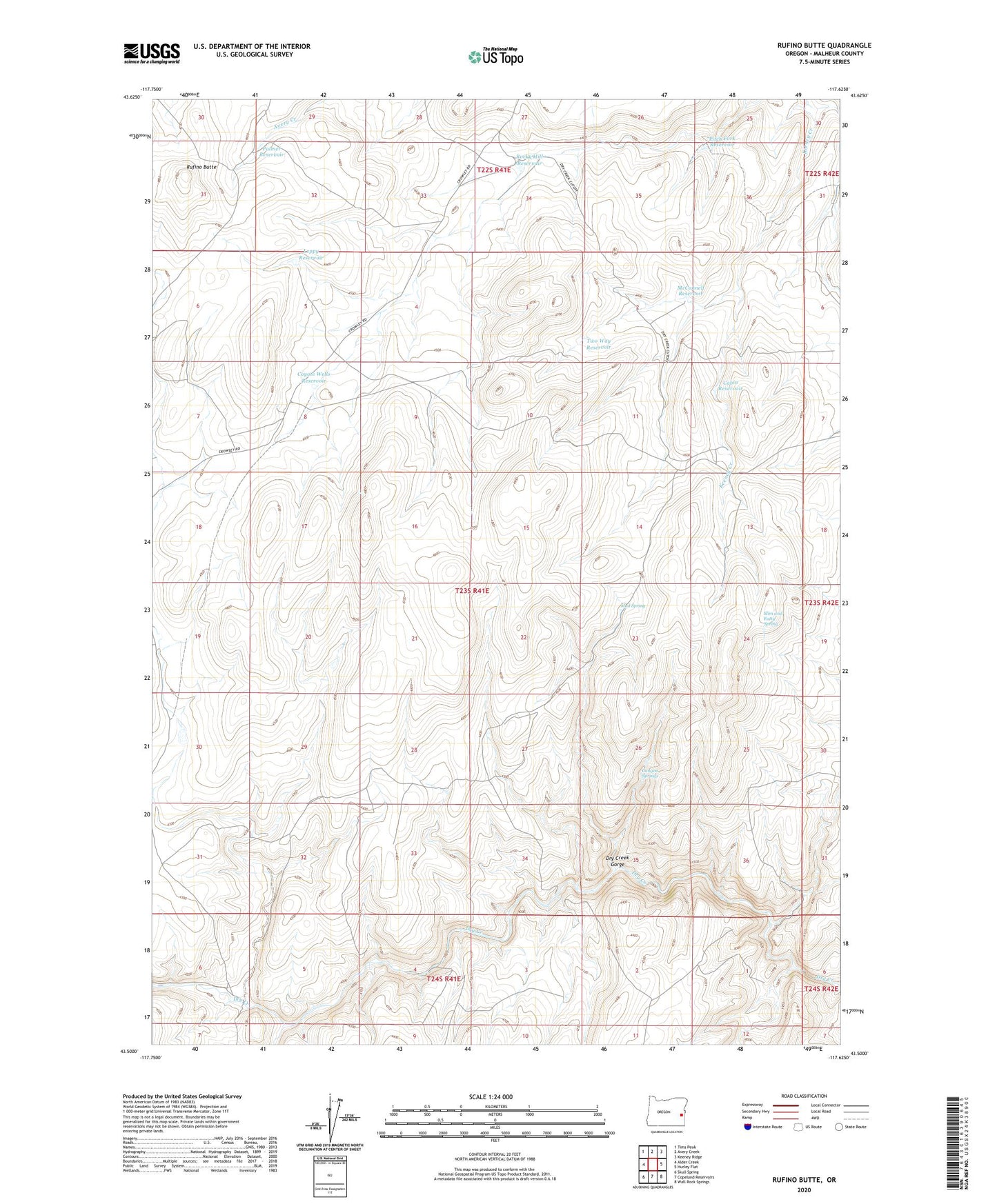
2024 topographic map quadrangle Rufino Butte in the state of Oregon. Scale: 1:24000. Based on the newly updated USGS 7.5' US Topo map series, this map is in the following counties: Malheur. The map contains contour data, water features, and other items you are used to seeing on USGS maps, but also has updated roads and other features. This is the next generation of topographic maps. Printed on high-quality waterproof paper with UV fade-resistant inks.
Quads adjacent to this one:
West: Alder Creek
Northwest: Tims Peak
North: Avery Creek
Northeast: Keeney Ridge
East: Hurley Flat
Southeast: Wall Rock Springs
South: Copeland Reservoirs
Southwest: Skull Spring
This map covers the same area as the classic USGS quad with code o43117e6.
Contains the following named places: Buckboard, Butte Creek, Cabin Reservoir, Canyon Springs, Coyote Wells Reservoir, Hard Rock Reservoir, King Brown Cabin, Leppy Reservoir, McConnell Reservoir, Mud Spring, Palmer Reservoir, Pitch Fork Reservoir, Rocky Hill Reservoir, Rufino Butte, Slim and Fatty Spring, Spring Coyote Wells, The Big Horse Trails, The Indian Trails, Two Way Reservoir