
MyTopo
Kaskela Oregon US Topo Map
Couldn't load pickup availability
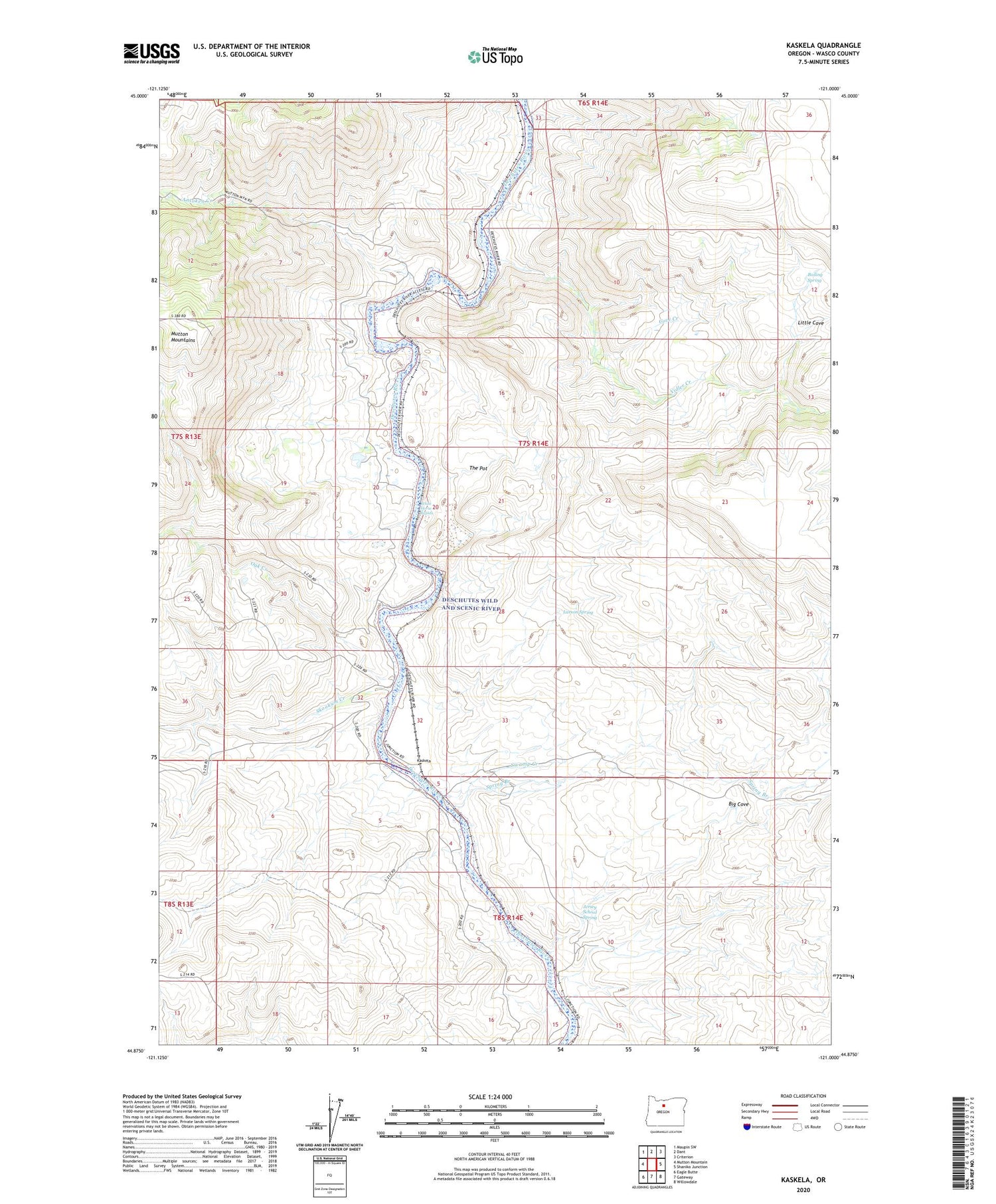
2020 topographic map quadrangle Kaskela in the state of Oregon. Scale: 1:24000. Based on the newly updated USGS 7.5' US Topo map series, this map is in the following counties: Wasco. The map contains contour data, water features, and other items you are used to seeing on USGS maps, but also has updated roads and other features. This is the next generation of topographic maps. Printed on high-quality waterproof paper with UV fade-resistant inks.
Quads adjacent to this one:
West: Mutton Mountain
Northwest: Maupin SW
North: Dant
Northeast: Criterion
East: Shaniko Junction
Southeast: Willowdale
South: Gateway
Southwest: Eagle Butte
Contains the following named places: Antoken Creek, Axford, Big Cove, Boiling Spring, Cove Camp, Cove Creek, Hardy, Hardy Ranch, Jersey School Spring, Kaskela, Kaskela Post Office, Larson Spring, North Junction, North Junction Post Office, Oak Creek, Skookum Creek, Spring Branch, Swamp Creek, The Pot, Vidler Creek, Whiskey Dick, Whiskey Dick Ranch, White Horse Rapids


