MyTopo
Gateway Oregon US Topo Map
Couldn't load pickup availability
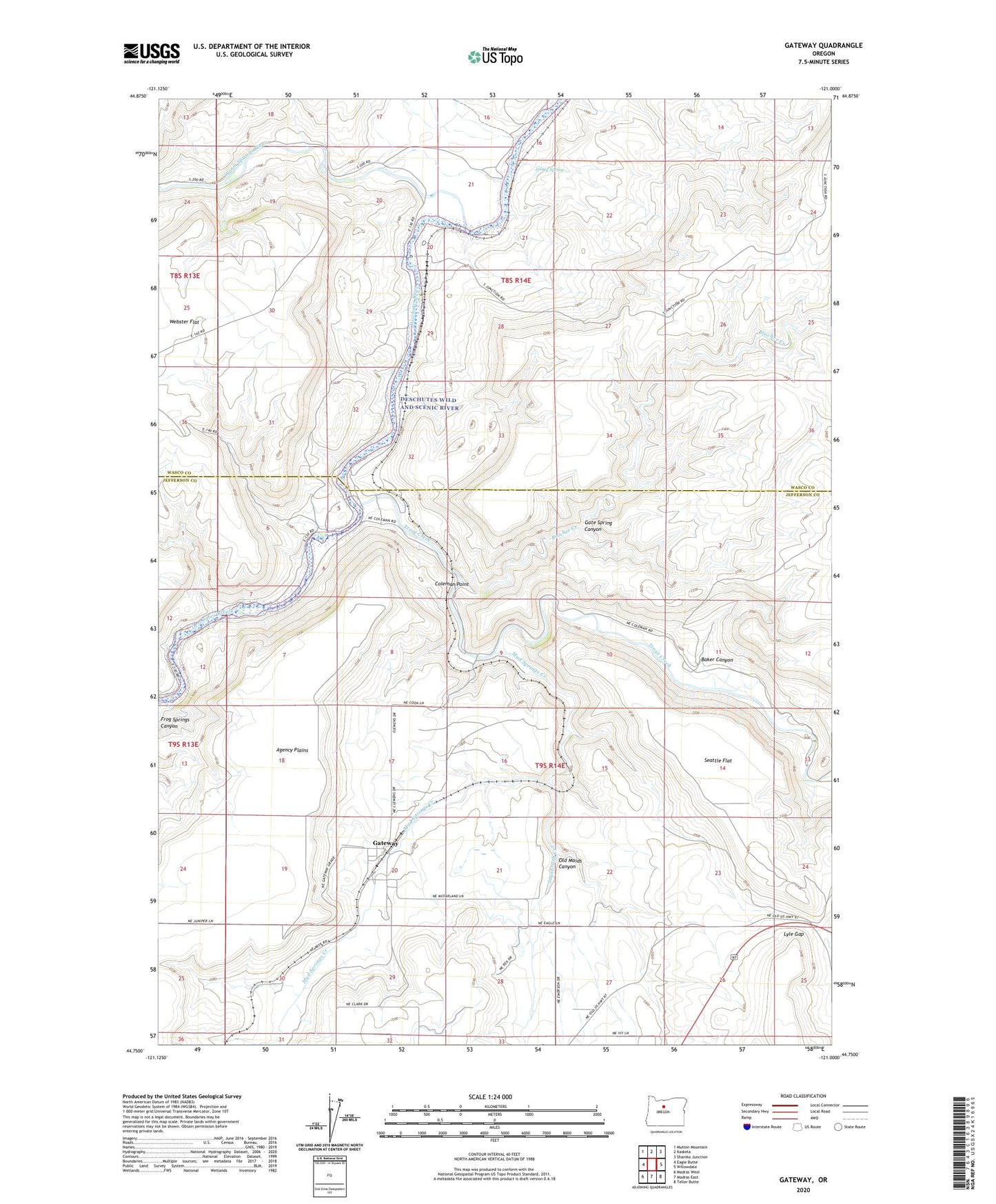
2023 topographic map quadrangle Gateway in the state of Oregon. Scale: 1:24000. Based on the newly updated USGS 7.5' US Topo map series, this map is in the following counties: Jefferson, Wasco. The map contains contour data, water features, and other items you are used to seeing on USGS maps, but also has updated roads and other features. This is the next generation of topographic maps. Printed on high-quality waterproof paper with UV fade-resistant inks.
Quads adjacent to this one:
West: Eagle Butte
Northwest: Mutton Mountain
North: Kaskela
Northeast: Shaniko Junction
East: Willowdale
Southeast: Teller Butte
South: Madras East
Southwest: Madras West
This map covers the same area as the classic USGS quad with code o44121g1.
Contains the following named places: Baker Canyon, Brocher Creek, Coleman, Coleman Point, Frog Springs Canyon, Gate Spring Canyon, Gateway, Gateway Post Office, Irvine, Jersey, Jersey Spring, Lyle Gap, Mud Springs Creek, Old Maids Canyon, Sagebrush Creek, Seattle Flat, South Junction, South Junction Post Office, Trout Creek, Trout Creek Campground Boat Ramp, Truman, Warm Springs River, Webster Flat, Youngs Post Office