MyTopo
Willowdale Oregon US Topo Map
Couldn't load pickup availability
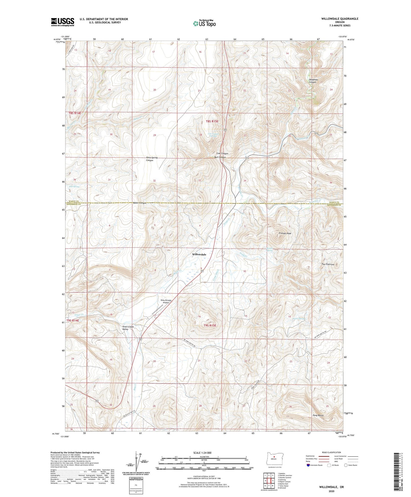
2023 topographic map quadrangle Willowdale in the state of Oregon. Scale: 1:24000. Based on the newly updated USGS 7.5' US Topo map series, this map is in the following counties: Jefferson, Wasco. The map contains contour data, water features, and other items you are used to seeing on USGS maps, but also has updated roads and other features. This is the next generation of topographic maps. Printed on high-quality waterproof paper with UV fade-resistant inks.
Quads adjacent to this one:
West: Gateway
Northwest: Kaskela
North: Shaniko Junction
Northeast: Shaniko Summit
East: Degner Canyon
Southeast: Ashwood
South: Teller Butte
Southwest: Madras East
This map covers the same area as the classic USGS quad with code o44120g8.
Contains the following named places: Antelope Creek, Bostick Spring, Bull Canyon, Carter Spring, Cow Canyon, Cow Canyon Safety Rest Area, Cow Canyon Springs, Cram Ditch, Cross Keys, Cross Keys Post Office, Deadman Canyon, Delco Creek, Friends Peak, Gate Spring, Hay Creek, Ochs Private Airport, Pony Butte, Pony Creek, Tenmile Creek, The Flatirons, Trout Creek Post Office, Trout Creek Valley, Ward Creek, Willowdale, Willowdale Post Office