MyTopo
Eagle Butte Oregon US Topo Map
Couldn't load pickup availability
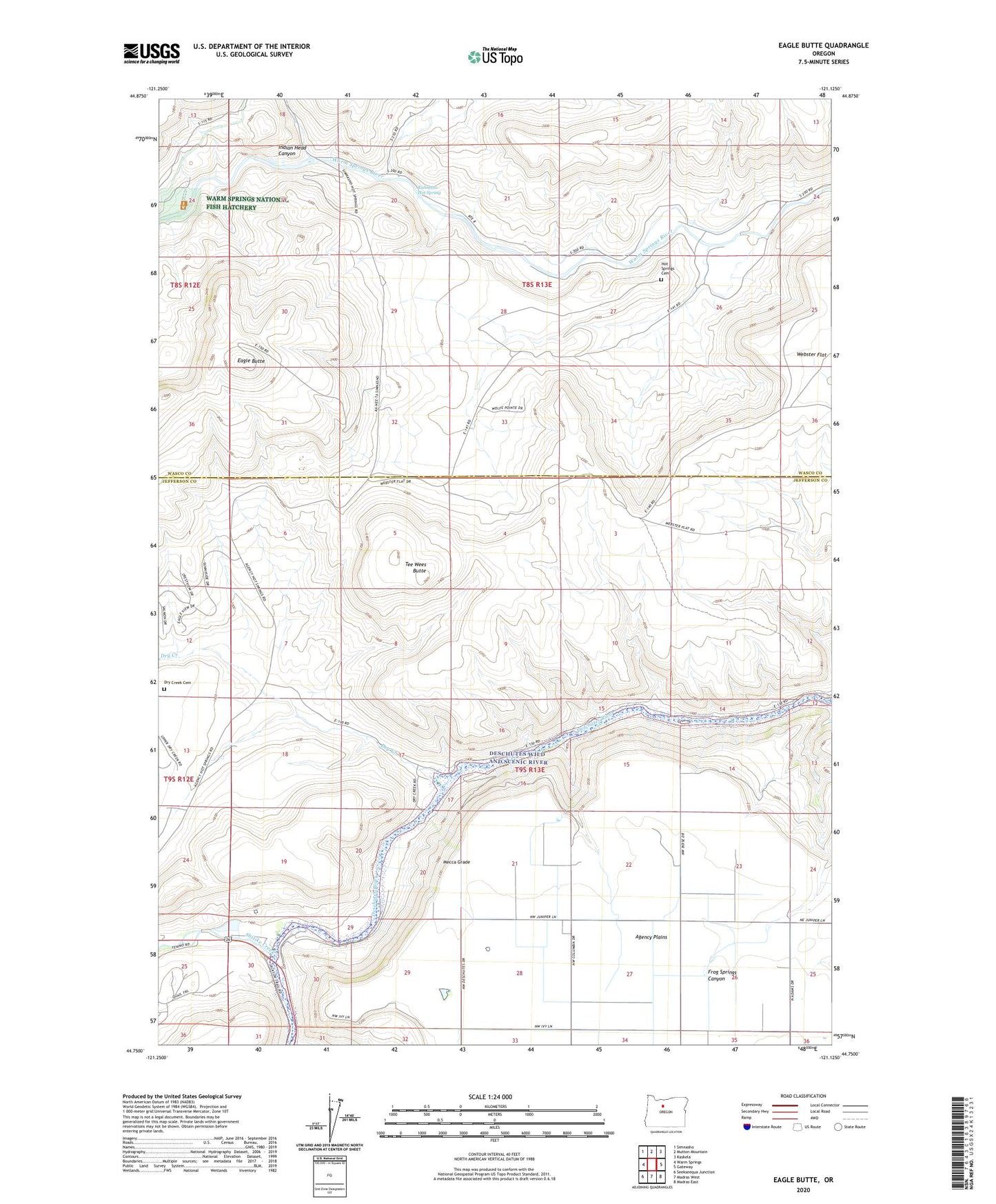
2024 topographic map quadrangle Eagle Butte in the state of Oregon. Scale: 1:24000. Based on the newly updated USGS 7.5' US Topo map series, this map is in the following counties: Jefferson, Wasco. The map contains contour data, water features, and other items you are used to seeing on USGS maps, but also has updated roads and other features. This is the next generation of topographic maps. Printed on high-quality waterproof paper with UV fade-resistant inks.
Quads adjacent to this one:
West: Warm Springs
Northwest: Simnasho
North: Mutton Mountain
Northeast: Kaskela
East: Gateway
Southeast: Madras East
South: Madras West
Southwest: Seekseequa Junction
This map covers the same area as the classic USGS quad with code o44121g2.
Contains the following named places: Dry Creek, Dry Creek Cemetery, Dry Creek Horse Camp, Eagle Butte, Hot Springs Cemetery, Indian Head Canyon, Kahneeta Hot Spring, Kah-Nee-Ta Resort, McKinley Corral, Mecca, Mecca Flat Boat Ramp, Mecca Grade, Mecca Post Office, Shitike Creek, Tee Wees Butte, Warm Springs Boat Ramp, Warm Springs Forest Products 1 - 3 Biomass Facility, Warm Springs National Fish Hatchery, Warm Springs State Recreation Site