MyTopo
Jordan Oregon US Topo Map
Couldn't load pickup availability
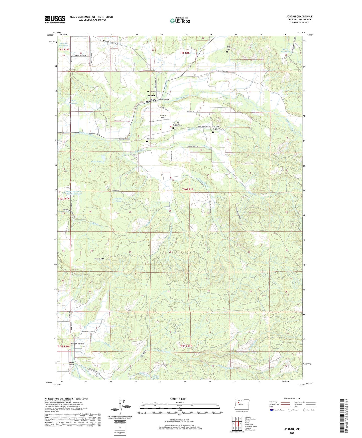
2023 topographic map quadrangle Jordan in the state of Oregon. Scale: 1:24000. Based on the newly updated USGS 7.5' US Topo map series, this map is in the following counties: Linn. The map contains contour data, water features, and other items you are used to seeing on USGS maps, but also has updated roads and other features. This is the next generation of topographic maps. Printed on high-quality waterproof paper with UV fade-resistant inks.
Quads adjacent to this one:
West: Scio
Northwest: Stayton
North: Stout Mountain
Northeast: Lyons
East: Snow Peak
Southeast: Keel Mountain
South: Lacomb
Southwest: Onehorse Slough
This map covers the same area as the classic USGS quad with code o44122f6.
Contains the following named places: Bear Creek, Bentz Ponds, Bilyeu Cemetery, Bilyeu Creek, Blue Creek, Burgen Creek, Burgen Hollow, Burmester Creek, Camp Morrison, Craft Creek, Gillette Field, Hafco Reservoir, Hannah Bridge, Humphrey Cemetery, John Shelton Cemetery, Jordan, Jordan Bridge, Jordan Creek, Jordan Guard Station, Jordan Post Office, Jordan Valley, Larson Ponds, Larwaood Wayside County Park, Larwood Bridge, Larwood Post Office, Lourdes School, Lyons Rural Fire Protection District Station 2, Our Lady of Lourdes Catholic Cemetery, Roaring River, Roaring River County Park, Roaring River State Fish Hatchery, Rogers Mountain, Rogers Mountain Ranch Reservoir, Scio Rural Fire Protection District, South Fork Neal Creek, South Roaring River, Wildwood Creek, Wilkes Reservoir, Ziebart Reservoir, Zurfluhs Ponds